Hike the Adolf Munkel Trail
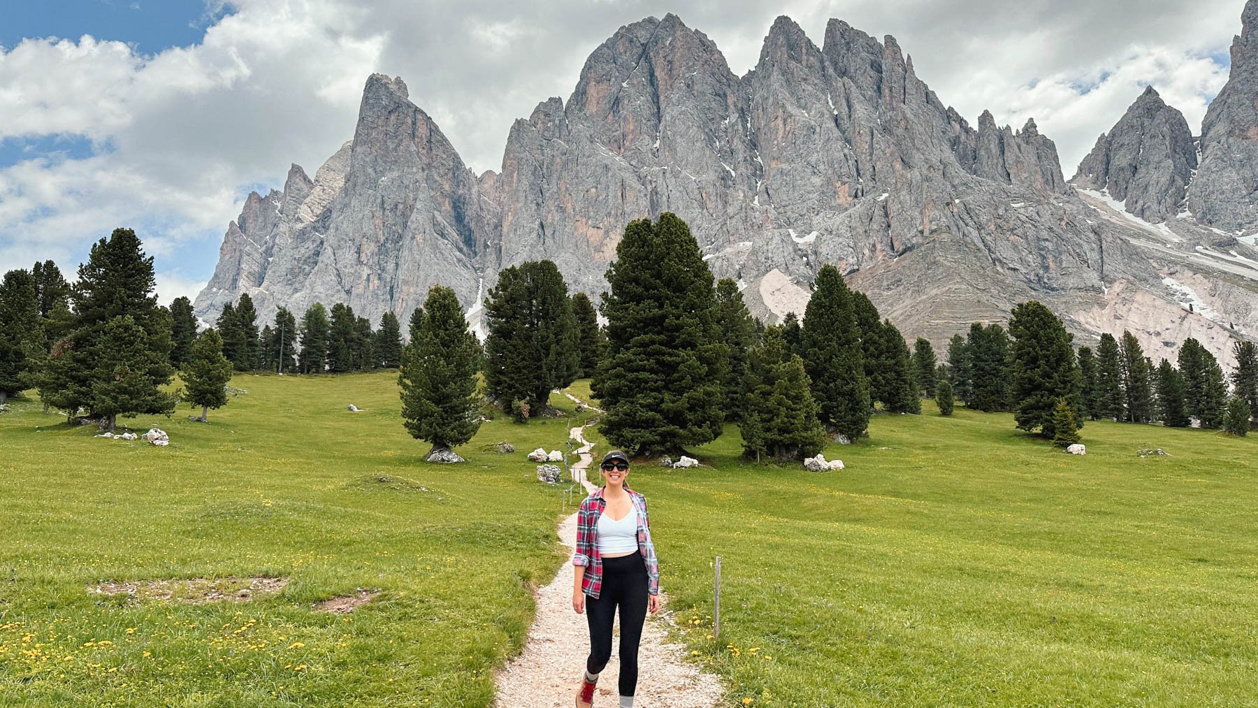
Hugging the base of the Geisler-Odle Mountains, the Adolf Munkel Trail offers great bang for buck. Indulge in breathtaking views and a variety of mountains huts full of delicious local treats, all along an achievable trail, it’s a great taster of hiking in the Dolomites.
It’s easy to see why the Adolf Munkel Trail is considered one of the best half-day hikes in the Dolomites.
A quick heads up: This post may contain affiliate links.
I only ever recommend products or services that I use (and love!) personally. You won’t pay anything extra if you make a purchase through one of these links, but we’ll get a small commission which helps keep the blog running. Thanks for your support!
KEY DETAILS OF THE ADOLF MUNKEL TRAIL
MARKED TRAILS | #35 & #36
DISTANCE | 9.5 km
TIME | 3 hours, plus breaks.
DIFFICULTY | Easy-Moderate (moderate elevation gain)
CONFUSED BY THE PLACE NAMES IN GOOGLE MAPS?
Villnöß or Val di Funes, Afdolf Munkel Weg or Via delle Odle? It can be a bit confusing when you first start researching places and things to do in the South Tyrol region of the Dolomites!
That’s because most places have both a German name and an Italian name, thanks to the rich history of the region where South Tyrol was part of what is now Austria. This has given the Süd-Tirol/Alto Adige province its own identity which such a different look, feel and way of life to other parts of Italy.
You’ll find throughout the region that all road signage, trail maps and restaurants menus feature both German and Italian versions. Further into nearby Val Gardena and Alta Badia, you’ll notice a third language too, as local language Ladin is also proudly spoken.
So embrace the diversity and speak whichever language comes most naturally, you’ll find the locals are bi-lingual and comfortable with either language, and can easily switch to English if necessary. Along the trail, you’ll almost certainly be greeted with a variety of salutations – a quick Ciao! (Italian), Hallo! or Guten Tag! (German), or Bun dé! (Ladin) are all welcome.
ADOLF MUNKEL TRAIL DESCRIPTION
Adolf Munkel Trail, also known as Adolf Munkel Weg in German and Via delle Odle in Italian, is a great half day hike at the foot of the Geisler-Odle mountain range in the Italian Dolomites.
But who is Adolf Munkel anyway? Adolf Munkel was the founder of the Dresden Alpine Association, and when the trail was established by the club in 1905, it was named after him.
The Adolf Munkel trail can be completed in either direction. We completed the trail in a clock-wise manner, heading South-East from Zannes Carpark, which seemed to be the most popular direction based on foot traffic that day. The following description follows this direction.

The Adolf Munkel Trail Map
PART 1 – TRAIL #35
Starting from Zannes Parking Lot 1, find the signs for trail #35 at the top of the carpark. There’s an upper and lower route, but the one you’re after is the lower route. The wide dirt road leads past Malga Zannes Alm and begins to wind through wooded farmland. We were fortunate to be greeted by a herd of grazing cows with their iconic bells jingling away – such a treat for your girl who had never heard them before!
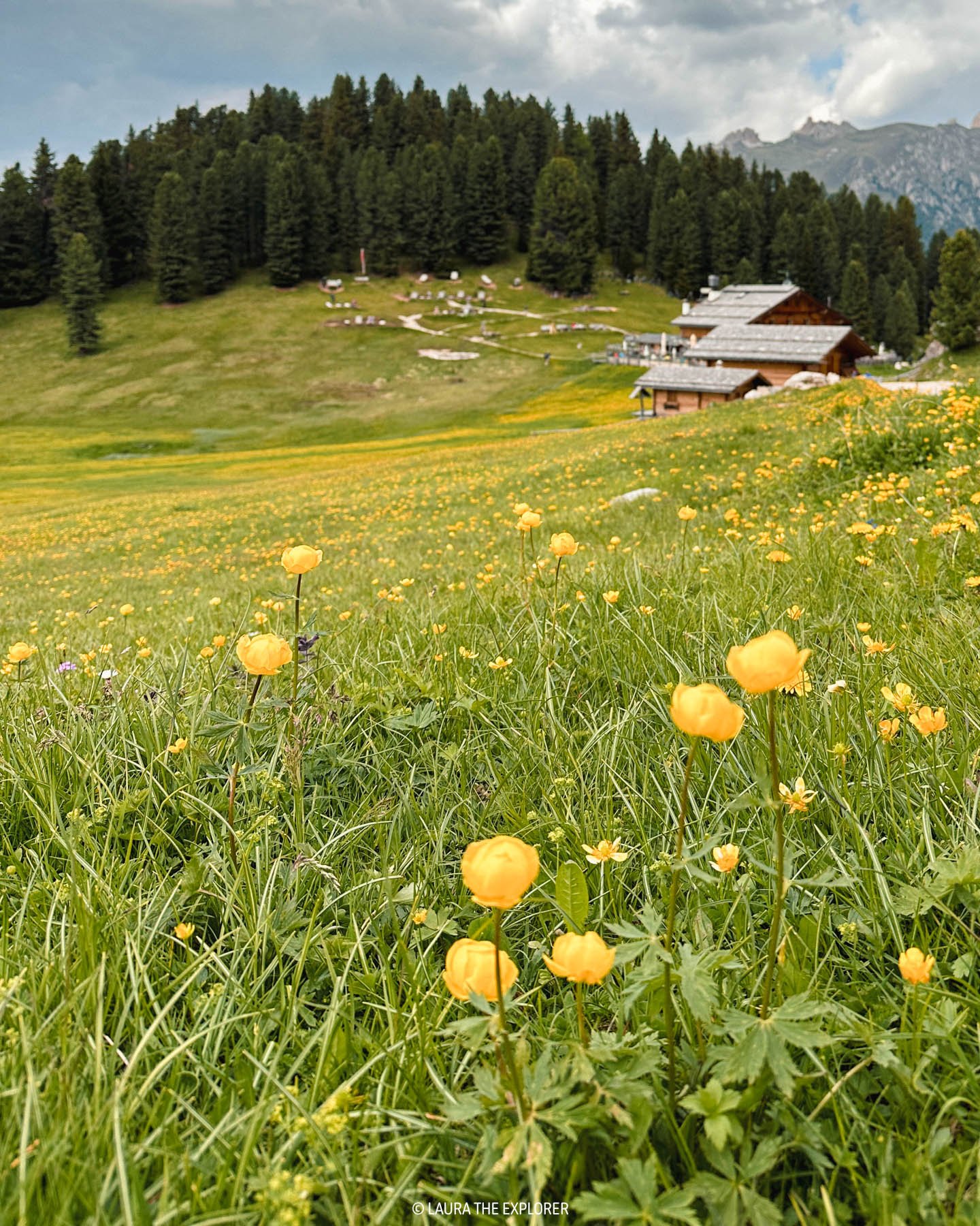
The trail continues to rise gently, following a stepped waterfall up as the views of the Geisler-Odle Mountains begins to open up and give you a taste of the epic views to come.
After a crossing a bridge over the waterfall, it’s time to leave the wide, dirt road and start heading up a narrower, rockier trail which will lead you closer and closer to the foot of the mountain. This section contains some of the best views of the Geisler-Odle Mountains and is a beautiful mix of rocky trails and wide open meadows.


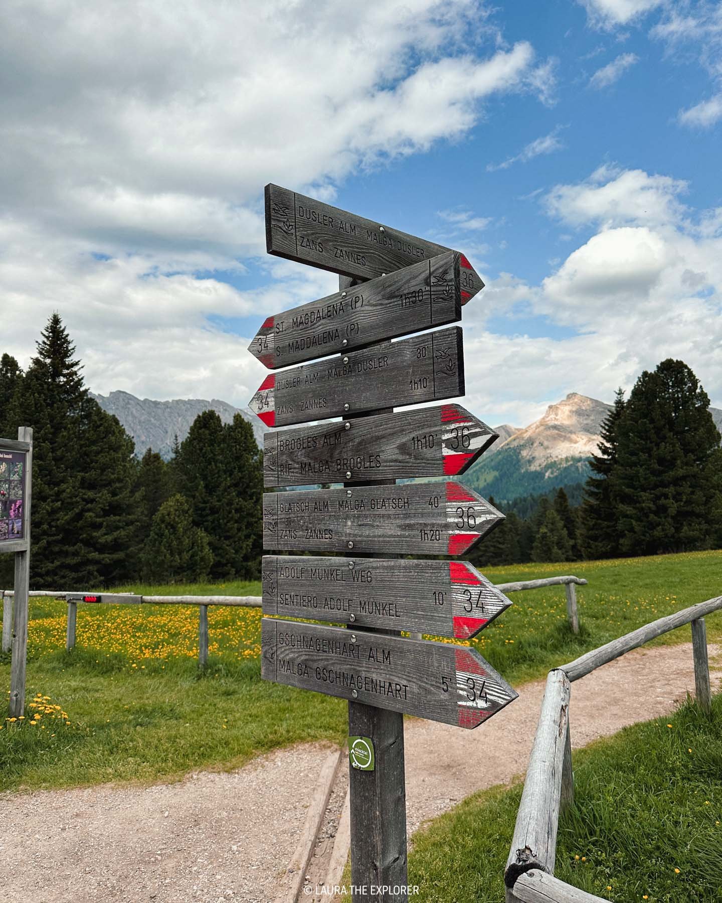
The trail continues and you’ll encounter sign posts indicating routes towards Geisler Alm/Rifugio delle Odle (either trail #36 or trail #36A), but continue on trail #35 for a bit longer. In fact, don’t turn off trail #35 until the third sign post to Geisler Alm (trail #36) at the foot of a staircase as shown in the photo below.

Don’t follow this sign for #36A, continue on #36

Do follow this sign #36 Geisler Alm
Before heading up trail #36, look back behind you and you’ll find an incredible viewpoint of the mountain towering above you.


PART 2 - TRAIL #36
This section of the trail will lead you through beautiful green meadows to two of the rifugios (mountain huts). Although the sign says it will take only 15 minutes, be prepared for it to take a bit longer because you’ll want to stop and take photographs every 30 seconds – the meadows are simply gorgeous and rushing through them is definitely not encouraged (despite a chilled beverage calling your name!).
If you’ve brought your own supplies, there’s plenty of space to spread out, make a picnic and take a rest amongst the wildflowers.

PART 3 – TRAIL #36 CONTINUED
After a stop for refreshments and with your back to Geisler Alm/Rifugio delle Odle, continue on trail #36 down past the children’s playground.
From here, the trail descends through some rocky, tree-root ridden terrain until you rejoin the road and arrive at Malga Dusler Alm, another spot for refreshments. Take care on this section, especially early in the season as it may still be recovering from the snow melt.
Follow the top marker back to Zannes carpark

After passing Malga Dusler Alm, the terrain switches from road back to trail (be sure to close the gates behind you!) and continues to descend all the way back down to the Zannes carpark. There are a nice views of the mountain ranges to the north, and you’ll even get some sneak peaks of the Val di Funes beyond. The trail finishes at the edge of Zannes Parking Lot 1 where it meets a private logging road.
Note: those with children may want to consider taking route #34 rather than route #36 from Geisler Alm back to Zannes as it follows the dirt road, rather than the trail, all the way down.
Find the Adolf Munkel Trail on AllTrails:
The trail described above is very similar to this map on AllTrails (the link starts from Parking Lot 2 and differs slightly from signage posts when departing Geisler Alm): Via Delle Odle.

ALTERNATIVES TO THE TRADITIONAL ADOLF MUNKEL ROUTE
START OR END AT RANUI (SANTA MADDALENA)
Starting or ending (or both!) from Santa Maddalena is a great alternative to the tradition circular route, particularly if you’re using public transport and want to explore Ranui and Santa Maddalena after the hike, or if you’re staying in Val di Funes and would prefer to walk from your accommodation rather than leaving a vehicle at Zannes Carpark.
Start at Zannes and finish at Ranui:
Follow Trail #35 and #36 as above, but after Geisler Alm, take trail #34 towards Santa Maddalena. This will follow the dirt road a good distance down the hill, before switching to a trail and heading east. As you get closer to the carpark, you’ll come to a river. Here you’ll switch to trail #28 and head north to Ranui.
The Geisler Alm to Ranui leg is approximately 5km in length and will take about 1hr 15m (being mostly downhill).
The return version of this trail can be found here on AllTrails: Santa Maddalena - Malga Geisler
EXTEND THE HIKE TO RIFUGIO BROGLES / BROGLESHÜTTE
To extend the hike further, it’s possible to continue on trail #35 until Rifugio Brogles / Brogleshütte.
Instead of turning off the Rifugio dell Odle/Geisleralm on trail #36, continue east along the foot of the mountains on the Dolorama trail for another 3.2km. From Rifugio Brogles / Brogleshütte, return the same way, or via #28 and #34A to connect up to the traditional loop, or via #28 all the way back to Ranui.
The additional leg is approximately 6.4km in length and will take an additional 2hrs (plus breaks).
Adding Rifugio Brogles / Brogleshutte to the traditional Adolf Munkel Loop can be found here on AllTrails: Rifugio Malga Brogles via Sentiero Adolf Munkel

HOW TO GET TO THE ADOLF MUNKEL TRAIL
The Adolf Munkel Trail is located in the beautiful Val di Funes (Villnöß) in the Italian Dolomites.
BY CAR
From the South, such as Bolzano/Bozen, take the Autostrada A22 exit for Chiusa/Val Gardena/Klausen/Gröden.
From the North, such as Brennero/Brenner or Brunico/Bruneck, take the E66 and/or Autostrada A22 exit for Bressanone/Brixen.
Then follow the smaller roads through the Val di Funes towards Malga Zannes/Zanser Alm.
BY PUBLIC TRANSPORT
It’s possible to reach the Adolf Munkel Trail via public transport.
Take the train or bus to Bressanone/Brixen station, and from there take bus 330 to the last stop on the line, Zanserhütte / Zanser Alm. Buses depart every hour and take about an hour, with the last return bus departing from Zanserhütte / Zanser Alm at approximately 6:30pm. Check the current bus schedules here.

Driving through the Val di Funes

WHERE TO PARK FOR THE ADOLF MUNKEL TRAIL
The easiest place to park for the Adolf Munkel Trail is in the large Zannes / Zanser Alm parking area.
There are three parking area – Parcheggio Malga Zannes 1, Parcheggio Malga Zannes 2, and a third area (not labelled in Google Maps) that is an extension of Parcheggio Malga Zannes 1. Note that “Parcheggio” is the Italian word for Parking.
Parcheggio Malga Zannes 1 is the main parking area with 5 rows of parking spaces. The extension is slightly larger again and is slightly closer to the trailhead.
Parcheggio Malga Zannes 2 is a much smaller area, and is slightly less conveniently located for the Adolf Munkel trail.
On a busy day, you’ll probably just need to take whichever space you can get, as during the peak summer season the carpark does fill up.
There is an electronic signboard just outside of Santa Maddalena village which shows if the parking lot is full or not. The road remains open, but you will need to queue in a one-out-one-in fashion at the parking entrance.
For reference, we arrived about 11am on a Friday in late June and Zone 1 was about half full, with the extension pretty much empty.
Just before entering the carpark there is staffed pay booth where you will be required to pay the parking fee in advance. A regular day pass costs €8.
When we departed in the late afternoon, the parking booth was closed and payment was no longer required, so if you’re looking to save a few euros, consider visiting later in the day. The trail will also be a lot quieter!


WHERE TO EAT ON/NEAR THE ADOLF MUNKEL TRAIL
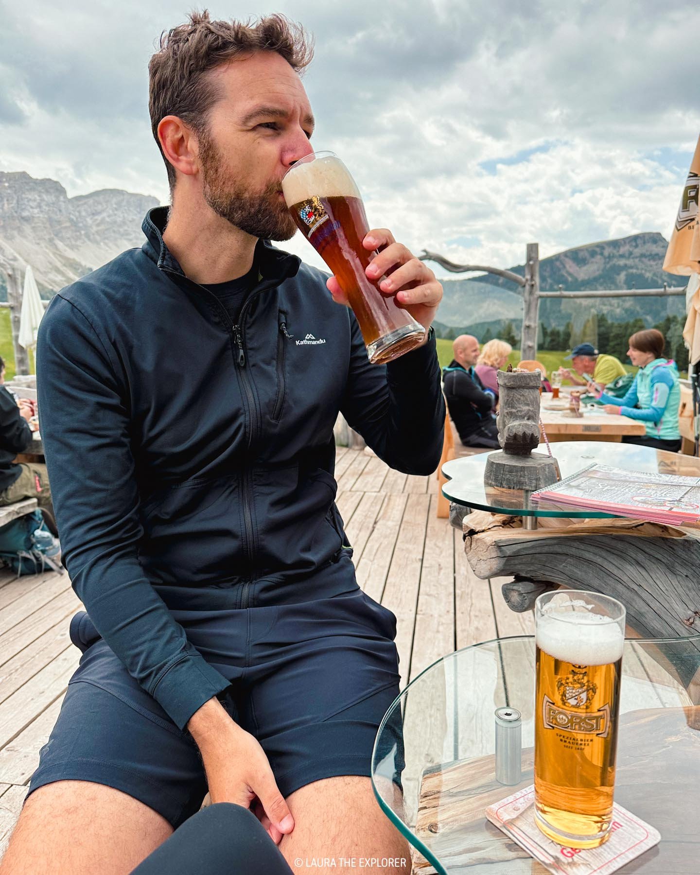
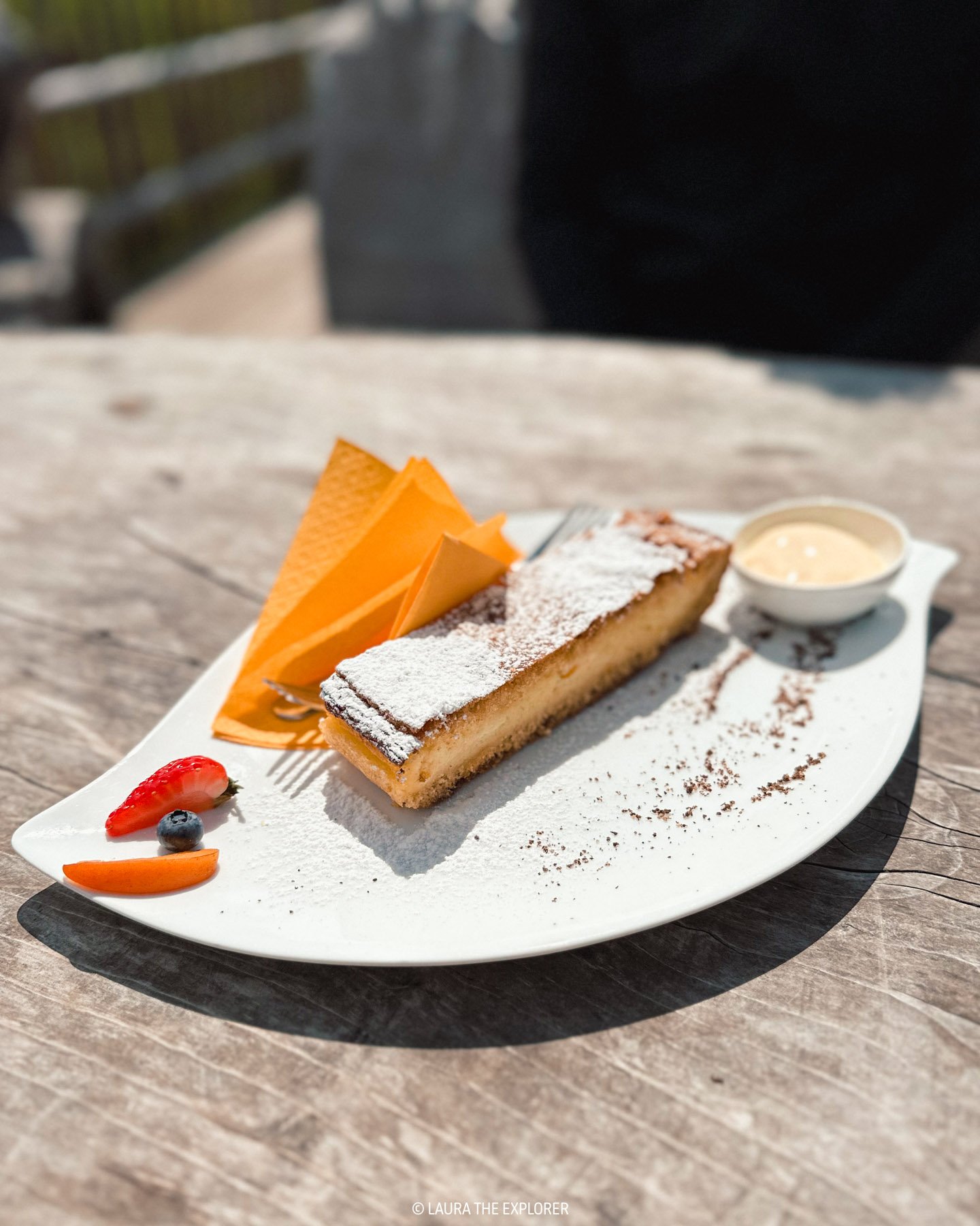
One of the best things about hiking in the Dolomites is the abundance of places to pop in for a beer and a strudel!
Along the trail itself there are three places to stop for refreshments:
Malga Casnago/Gschnagenhardt Alm
Both Malga Casnago and Rifugio Odle are located at about the halfway point of the hike, in the large meadow at the foot the Geisler-Odle mountains. Malga Casnago is smaller and a good place if you prefer somewhere a bit quieter.

Malga Casnago
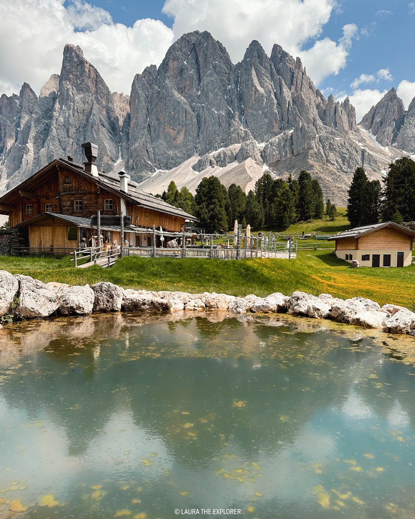
Rifugio Odle/Geisler Alm
Rifugio Odle is larger and has more amenities for families, such as a playground. There’s also the famous Geisler Alm Cinema, where you can sit back and take in the ever changing view of the mountains beyond.

Geisler Alm/Rifugio delle Odle


When we hiked the trail on the second last weekend of June, only Rifugio Odle/Geisler Alm had opened for the season, so we popped in for a beer and a strudel!
Malga Dusler/Dusler Alm
Malga Dusler is located about halfway between the other two spots and the parking lot. It’s also well set up for families with plenty of space and activities.
Zannes
There are also a couple of options located close to the parking area, if you’d prefer something before or after the hike:
Treffpunkt Alm
Malga Zannes/Zanser Schwaige
Further afield, there are a few restaurants in the village of Santa Maddalena. Note however that hours and months of operation may be limited as Santa Maddalena is a small, local village.
THE BEST TIME TO HIKE THE ADOLF MUNKEL TRAIL
THE BEST MONTH
The Adolf Munkel trail is generally clear and accessible from late May/early June through to October, but it depends on the timing of the snowfall. In May, the meadows will be full of beautiful wildflowers. During autumn/fall, the orangey-red foliage is a popular attraction in the Dolomites.
Over the winter it’s also possible to hike the trail, though slightly differently – it turns into a snowshoe and toboggan trail! In the winter season, be sure to prepare well for alpine winter conditions and follow any local safety advice, such as avalanche warnings.
Read More: Why You Should Visit the Dolomites in June
THE BEST TIME OF DAY
For the best time of day, the afternoon light hitting the Puez-Odle mountains is generally considered the best for photographers. During peak season, arrive either early morning or late afternoon to avoid delays in getting a parking space.
WHAT TO WEAR & WHAT TO PACK FOR THE ADOLF MUNKEL TRAIL
The weather can change quickly in the Dolomites, so you need to be prepared for all conditions on a hike.
HIKING BOOTS OR TRAIL RUNNERS
The trail features both loose gravel paths and muddy, tree-root ridden paths, so supportive, grippy footwear is a must! This is not really the trail for white gym sneakers.
WIND/WATER RESISTANT JACKET
Even if the outlook calls for sunny skies, always pack a warm, protective jacket.
LAYERS
If the clouds roll in, the temperatures can drop quickly. Be prepared by wearing or packing layers of clothing. Our day started off hot and sunny, but temperatures quickly dropped when some clouds rolled in.
On a day hike I'm usually wearing:
A pair of black leggings (the pockets are a win!)
A comfortable tank top
A breathable tank top
SUN PROTECTION
The sun is more damaging at higher altitudes so be sure to pack a hat and sunscreen.
PLENTY OF WATER
Whilst the mountain huts can provide various forms of hydration, always carry a water bottle. The first half of the hike is uphill so you’re going to want some water on hand!
CASH/CARD
If you’re going to stop in at the huts, carry cash or card. The Geisleralm accepted foreign credit cards without a problem. You’ll also need to pay the parking fee.
MOBILE PHONE/ SATELLITE/GPS DEVICE OR PLB (PERSONAL LOCATOR BEACON)
Whilst the Adolf Munkel Trail is easy to follow and doesn’t go too far from infrastructure, it’s always good practice to carry a communication device in case you run into any difficulties!
RUBBISH
If you pack it in, make sure to pack it out! Dispose of any rubbish thoughtfully once you finish the hike.

It started out hot and sunny…

…until the afternoon clouds rolled in
WHERE TO STAY NEAR THE ADOLF MUNKEL TRAIL
If you’d like to base yourself in the beautiful Val di Funes, there are a range of traditional guesthouses and hotels to choose from, however get in early as the limited supply books out well in advance.
This hotel is perfectly located in the village of Santa Maddalena and would make the perfect base for a couple or small family to explore the Val di Funes. There’s also the added benefit of it having one of the only restaurants in the village.
This luxury hotel is also conveniently located in the village of Santa Maddalena and would make a luxurious base for a couple. The hotel also features a traditional South Tyrollean restaurant.
WHAT ELSE TO DO IN VAL DI FUNES
The Val di Funes is one of the most picturesque places in the world, and lit up at sunset, it’s pure magic. It’s a must do on your Dolomites road trip!
Be sure to check out these other highlights of the Val di Funes:
CHIESETTA DI SAN GIOVANNI A RANUI
This iconic church is one of the most well known vistas in the Dolomites, and is actually one of the easiest views to lay your eyes on! Nestled into the side of the road in the hamlet of Ranui is a small platform, the best place is to take a photo and avoid trespassing on the local farmer’s fields.
It’s possible to visit the church up close via a dedicated accessway from Ranuihof Lodge, the owner of the church property. As the church is private property, a small fee is required.
The closest parking spot is just on the corner near the viewpoint.


VISTA OF CHIESA SANTA MADDALENA
If the iconic shot of Chiesetta di San Giovanni isn’t the one that caught your eye, then the panorama of Chiesa Santa Maddalena surely is. Perched on a small hill above the idyllic village of Santa Maddalena, this church makes a great focal point for a picturesque view of the Val di Funes.
For the best views, park up in one small parking areas in town, and then walk 20-30 minutes up the nearby hill for a range of great viewpoints.
Note that only locals are permitted to drive up these roads, and please avoid walking through the farm fields – they’re private property and not there for frolicking through for the instas! We saw a farmer have to appear several times to ask multiple groups of people to get out of his growing hay, which was really disappointing to see. It should go without saying, but stick to the roads, or the marked Panoramaweg trail.

OTHER HIKES IN THE DOLOMITES
LAGAZUOI TUNNELS HIKE
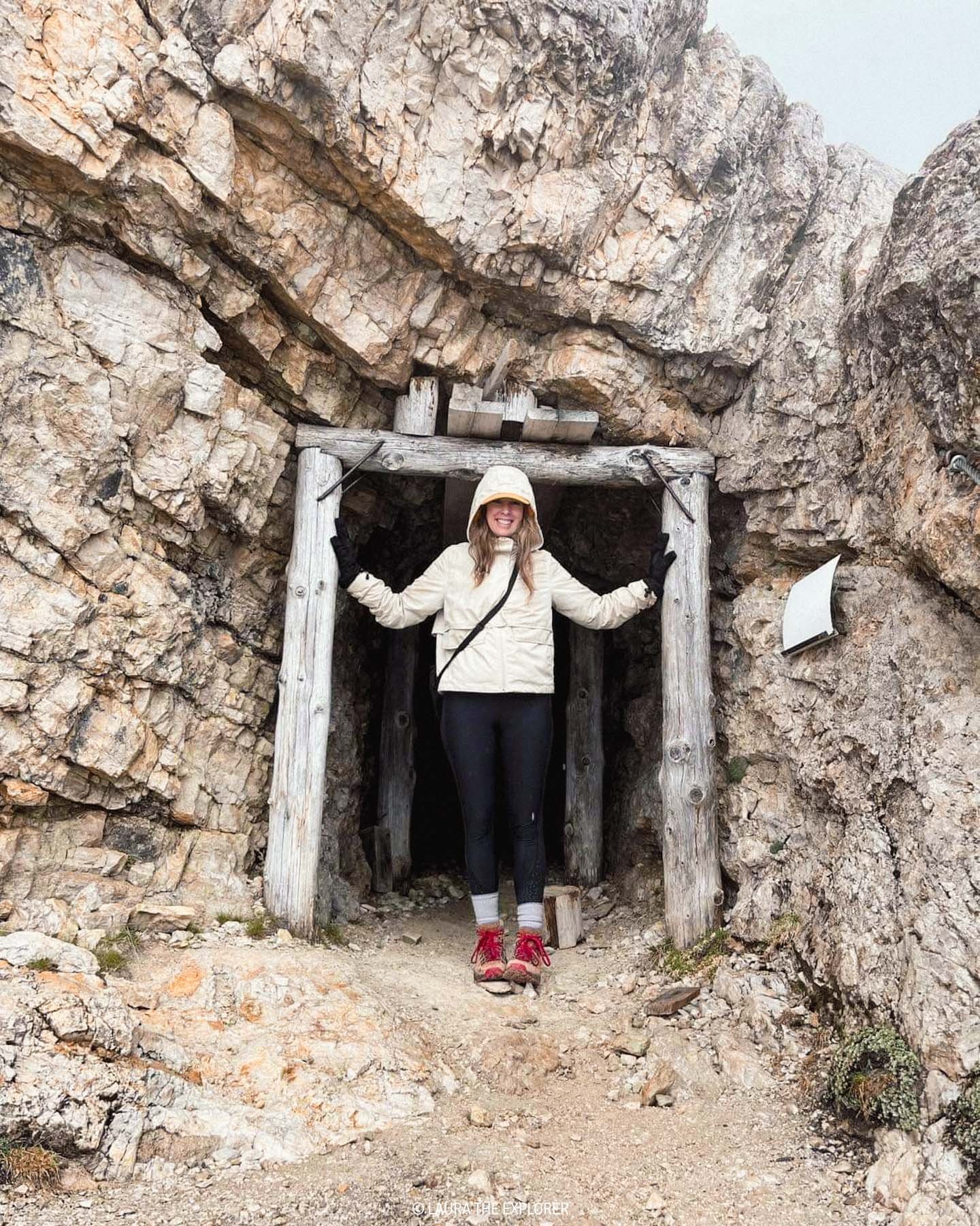
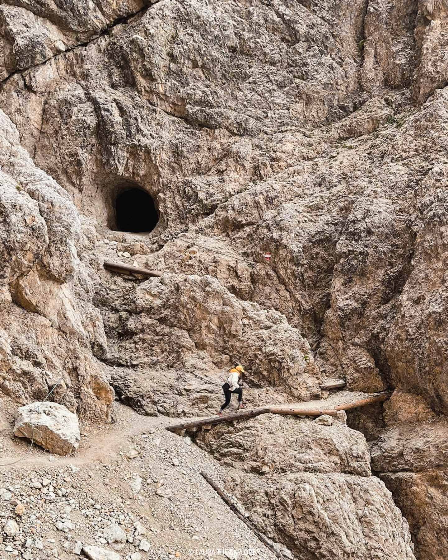
The Lagazuoi Tunnels were one of our favourite adventures in the Dolomites. Starting up top of Mt Lagazuoi where you’ll find incredible views worthy of a visit on their own, this hike will lead you along the footsteps of World War I soldiers, descending through tunnels created in the battlefield between Italy and Austria.
Come prepared with a good headlamp (a phone light won’t suffice), hiking boots and a pair of gloves. A helmet is also recommended, but a harness isn’t required. This hike might put you a little outside of your comfort zone, with long stretches in complete darkness and a few loose gravel paths to navigate, however the rewards make all of precautions worth it.
Take the gondola up to the top of the towering rock (aka Mt Lagazuoi), grab a bite to eat from the delicious rifugio, then make your way through the WWI tunnels (barbed wire and all) to find the entry to the tunnel network. Once inside follow the stairs and trail all the way down. You’ll find various side trails and viewpoints scattered throughout, though as long as you’re heading down then you’re going the right way. Once you emerge from the tunnel, follow the trail around the cliff face and down the switchbacks to reach the parking lot at the bottom – and be sure to keep out for the mammots hanging out in the rocks on your way!
TRE CIME DI LAVAREDO HIKE
It’s probably one of the most well known sights in the Dolomites, but despite it’s popularity, the Tre Cime di Lavaredo loop is another hike you can’t miss. Starting at Rifugio Auronzo, circumnagivate these iconic three towers as you take in the beauty of the surrounding valleys and optional (but worthy!) side trails.
Sorting the logistics is key to hiking the Tre Cime di Lavaredo loop. Either plan on arriving early to take the toll road up the parking lot near Rifugio Auronzo, or park near Misurina and take the dedicated bus up from there. It’s possible to arrive via bus from Toblach/Dobbiaco and Cortina d’Ampezzo too. Whichever way you get there, arrive as early as possible to beat the crowds that inevitably descend on this hike each day of the summer season.
From the carpark, head anti-clockwise past Rifugio Auronzo and Rifugio Lavaredo to the Lavaredo Pass where the iconic views of the Tre Cime (Three Peaks) start to unfold. After taking all of the photos, follow the trail around to Rifugio Locatelli where there are plenty of sidetrails offering tons of unique viewpoints of both the Tree Peaks and surrounding mountains and valleys. From here, it’s a sharp downhill, then a sharp uphill before the trail winds back around the base of the peaks to the carpark. To make a full day of it, be sure to check out the caves and Sasso di Sesto peak behind Rifugio Locatelli, and the majestic Cadinini di Misurina.

LAGO DI SORAPIS HIKE
The Lago di Sorapis hike has exploded in popularity thanks to the intoxicating cloudy, turquoise waters of this glacier fed lake. This in-and-out trails leads up through the tree line, over seasonal glacial riverbeds, up rocky staircases and along paths carved into the cliff face to arrive at this unbelievably blue lake.
Arrive early to beat the crowds and find a parking spot near the trailhead (of further around the corner in a dedicated parking lot). The in-and-out nature of the trail means that if arriving later in the morning, you’re going to be navigating other hikers heading in both directions on this mostly single file trail. So, pick a sunny day and head out early and you’ll be rewarded with the best lighting across the lake and surrounding mountains before it gets too crowded.
This hike is best tackled early in the season when the water levels are high, but make sure to pack proper hiking boots or trail runners as the trail can also be pretty wet and muddy in areas. Leave the white sneakers behind for this one! Whilst it can be tempting to take a quick dip, swimming is strictly prohibited due to any disturbances muddying the delicate water. Instead, head over to Rifugio Alfonso Vandelli for an icy cold beverage at their patio bar. The views down the valley are also pretty epic from here too!

LAGO DI BRAIES HIKE
Lago di Braies is probably the most visited attraction in the Dolomites, but in my opinion, it’s for good reason. The sun rising over the surrounding mountains and illuminating the silky green water is simply magical. After taking in the iconic boatshed, hike the Lago di Braies loop trail around the lake to discover some far less busy but just as beautiful vistas of this jewel in the Dolomites crown.
Sticking with the theme of popular Dolomites attractions, the trick here is also to arrive early – we’re talking sunrise, or before 7am during peak season. So, grab your wooly hat and a warm jacket and not only will you get the most picturesque lighting, but you’ll beat the tour bus arrivals too. Arriving early means you’ll find plenty of parking space – by mid-morning the carparks will be full and queues will form. Also be prepared if visiting from early July to early September as a pre-purchased permit and parking pass are required to drive into valley between 9:30am and 4:00pm.
Once you’ve arrived at the boat shed, picked your jaw up off the ground, and taken a million photos, do what most people don’t do and head out on the hike around the lake. It’s a pretty easy stroll that doesn’t gain much in terms of elevation and is a great way to stretch your legs for the day ahead. The trail will be much quieter than the area around the boatshed and hotel, with lots of unoccupied viewpoints to discover along the way.

This blog post was about:
» Looking for more hikes? Try one of these: