New Zealand 2 Week South Island Road Trip - A Local’s Guide

Snow-capped mountains, foaming waterfalls and wild sandy beaches provide the backdrop to breathtaking hikes, adrenaline filled adventures, world-class wineries and unique wildlife.
This itinerary is full of tips and inspiration to plan an incredible two weeks in New Zealand’s South Island.
The South Island is the place I call home.
Even though I’ve lived either overseas or in Auckland since I finished studying, whenever asked where I’m from, Dunedin is my answer. From family holidays, to adventures with friends (both local and from around the world), to roof-top tent road trips, I’ve been lucky enough to see exactly what this incredible corner of the world has so much to offer.
Meet incredible wildlife in Kaikoura & Dunedin, discover the secluded beaches of Abel Tasman, follow the icy glaciers of the West Coast, climb epic trails and sample world-class wines in Central Otago, stand in awe of Milford Sound, experience the rugged and remote Catlins, stand in the shadow of Aoraki/Mt Cook and jump from one turquoise blue lake to another.
Based on my life-long experiences and adventures, I’ve put together what I consider to be the perfect route for a 2 week south island road trip in the South Island - this guide is full of local tips and inspiration for planning the ultimate New Zealand adventure.
ITINERARY
Day 0: Arrival/Christchurch
Day 1: Kaikōura
Day 2: Marlborough
Day 3: Abel Tasman National Park
Day 4: Buller Gorge & West Coast
Day 5: The Glaciers
Day 6: Haast & Makarora Valley
Day 7: Wānaka
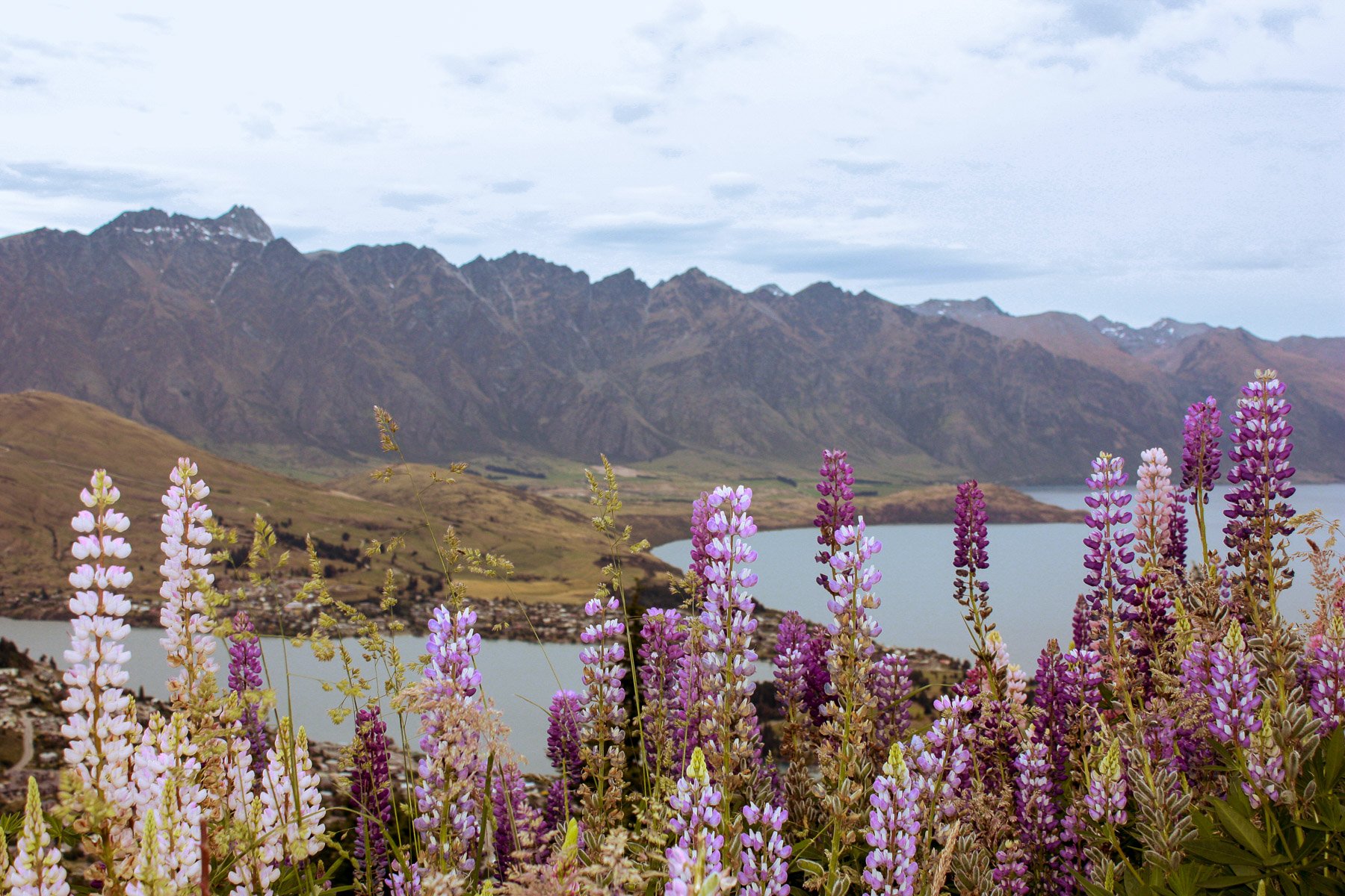
Day 8 & 9: Queenstown
Day 10: Milford Sound
Day 11: The Catlins
Day 12: Dunedin
Day 13: Aoraki/Mt Cook
Day 14: Tekapo
A quick heads up: This post may contain affiliate links.
We only ever recommend products or services that we use (and love!). You won’t pay anything extra if you make a purchase through one of these links, but we’ll get a small commission which helps keep the blog running. Thanks for your support!
SOUTH ISLAND ARRIVAL AND TRANSPORT OPTIONS
This itinerary is based on the assumption that you’ll be arriving on a flight into Christchurch, the main air hub on the South Island and the common way to arrive into the South Island.
The route can also be easily adapted to suit a variety of starting points due to it’s circular route. It’s totally possible to arrive via the Interislander Ferry into Picton in the Marlborough Sounds, perhaps as part of a wider New Zealand trip, or on a flight into one of the other main centres such as Queenstown or Dunedin.
» GETTING AROUND THE SOUTH ISLAND
Public transport between towns is pretty limited, making it quite hard to tour around on a set timeframe.
Therefore travelling by rental car, campervan, or by using a dedicated tourism bus network is the easiest way by far to get around New Zealand.
CAMPERVANS
Roadtripping in a campervan is one of the most popular ways to see New Zealand. Motorhome Republic is a great resource for comparing all kinds of campervan rentals, from self-contained vans to full 6-berth campers.
CARS
For car rentals, all major international brands are available in Christchurch, along with local Australasian options such as Apex.
UNIQUE TRAVEL
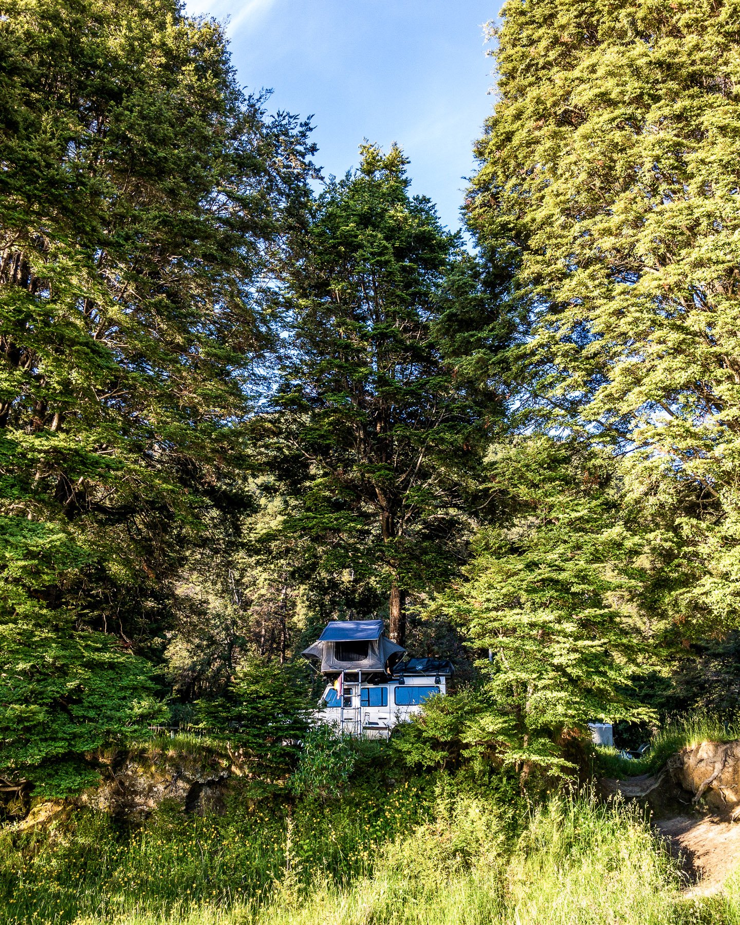
We had a great week exploring some of the South Island in a 4WD Landrover equipped with a rooftop tent from Trekker Adventure, which was a LOT of fun! The slight difference between these trucks and a campervan is that they’re not self-contained so you’ll need to stay at campsites with appropriate facilities.
TOURIST BUSES
Bus networks such as The Kiwi Experience are a great way to see New Zealand, especially for those travelling alone or who may be too young to rent a vehicle without all the additional fees.
The hop-on-hop-off style means you can plan route and duration to suit your own itinerary.
DRIVING IN NEW ZEALAND
Driving in New Zealand is very different to driving in other countries. Whilst traffic is (generally) very calm, the roads tend to follow the curves of the environment - there’s very few dual-carriage motorway or highways here!
» FOLLOW THESE DRIVING TIPS:
Drive on the left! In high risk areas, you’ll see arrows on the road indicating the direction of travel.
Speeds are in kilometers not miles. Permitted speeds are shown on round, white signs with red borders. On corners you’ll often see an Advisory Speed, indicated on a yellow diamond sign - this is the recommended speed to safely navigate the corner.
Utilise slow vehicle bays if you’re driving slower than the speed limit, especially in gorges or other areas with limited passing options.
There is no free left turn on a red here (ie. the free right turn on a red common in North America) - await a green arrow or the regular green light.
Travel times on google maps are pretty accurate, but allow extra time especially if you’re in a large campervan or a windy road where it’s unlikely to possible to go 100km/h.
Overtaking is only possible where a broken white line separates the flow of traffic, do not pass on a solid yellow line - these are used where it is unsafe to pass.
“Yield” signs are called '“Give Way” signs in New Zealand.

SUPPLIES FOR A SOUTH ISLAND ROAD TRIP
» PETROL/DIESEL PRICES
There’s no easy way to avoid this one - petrol is expensive in New Zealand. From our isolated location to government taxes, expect to pay over $2.50/l for 91 petrol or $1.70/l for diesel in main centres, more in isolated areas. I highly recommend downloading the Gaspy app to find live prices at local stations.
» FOOD & GROCERY STORES
Cities and main town centres contain a variety of the major supermarket chains - these are New World (a little fancier), Woolworths, and Pak n Save (budget).
Small towns and villages will have a smaller grocer chain - Four Square, Fresh Choice and Super Value.
Try and stock up when staying outside of towns and villages as grocery store options can be limited, in particular there is only a cafe in Milford Sound (no general store), and options are sparse in the Lewis and Arthurs Passes, Haast Highway and the Catlins.
» CONNECTIVITY
4G cellphone reception is available in main centres, but can be limited in mountainous and remote areas. The main providers are Spark and Vodafone, with other providers such as 2degrees and Skinny piggy-backing off Spark & Vodafone transmitters. Coverage does vary between the two main providers, so if you’re travelling in pairs or a group, it’s helpful to mix up your providers. Wifi is widely available at accommodation and restaurants, except for Department of Conservation campsites.
» WEATHER IN THE SOUTH ISLAND
New Zealand is the kind of country where you can get four seasons in one day and even snow in summer is not unheard of! Download local weather app MetService for up to date reporting.


2 WEEK SOUTH ISLAND ROAD TRIP ITINERARY
This itinerary is based on 14 days in the South Island, with some additional suggestions that I’ve also added along the way if you have additional time and want the opportunity to complete an overnight or multi-day hike - the route passes close to many of the Great Walks trailheads, along with many other equally impressive walks.
DAY 0 - CHRISTCHURCH (ŌTAUTAHI)
Arrive into Christchurch and pick up your rental car or camper van from the airport. Hopefully, your arrival flight allows some time to explore the revitalised city centre, including a stroll along the Avon River at Oxford Terrace and a look at the Cardboard Cathedral, built to temporarily replace the original Cathedral that was destroyed in the 2011 earthquake.
DAY 1 - NORTH CANTERBURY & KAIKŌURA
Drive Time: 2hr 30m | Drive Distance: 180km
Before heading straight out of town, start the day by taking a walk around the beautiful Christchurch Botanical Gardens, located in North Hagley Park. Here you’ll find Ilex Cafe to grab a coffee (try the staple flat white) and breakfast before hitting the road.
» WAIPARA
Not too far out of Christchurch is the first wine region of the itinerary, Waipara. As much as we love the great outdoors, nothing beats a glass of wine on the land it was created, and this region in North Canterbury is home to some award-winning wineries. Stop in to Pegasus Bay or Black Estate cellar doors and pick up a bottle or two to take on your adventure - a great way to toast your arrival to the South Island!


» KAIKŌURA
Kaikōura is world-renowned for it’s wildlife, in particular it’s whale and dolphin watching opportunities. The best way to experience Kaikōura is via a specialised boat tour. Book in advance for a Whale Watch Tour or Dolphin Encounter and see these majestic creatures safely in their natural habitat. Boat tours are available year round, with timings varying to suit the season.
Ethical Travel Tip: Animal Tourism is a huge issue in many countries and it’s import to carefully research any activity involving animals. For these tour operators, sustainability, conservation and education are core values of their businesses. As the only operators in Kaikōura, tours are focused on supporting the ecosystem, not commercial competition, and are committed to the Tiaki Promise.
Before or after your tour, head out for a walk along the Kaikōura Peninsula Walkway to the see the local seal colony relaxing on the rocks.
End the day with the kiwi classic fish and chips from local institution Coopers Catch.


» ACCOMMODATION NEAR KAIKŌURA
Campervan | Alpine-Pacific Holiday Park
Located along the main Kaikoura strip, pull up and watch the sun set over the snow capped mountains.
Mid-Range | Panorama Motel
This classic kiwi motel is located right on the water front with spectacular views.
Luxury | Hapuku Lodge
Hapuku Lodge is a luxurious eco-friendly lodge located just north of Kaikōura, where accommodation options include tree houses up in the native bush canopy.
DAY 2 - MARLBOROUGH
Drive Time: 4h 15m | Drive Distance: 310km
» BLENHEIM
Wine might be a bit of theme on this itinerary, but when it passes through some of the best wine regions in the country (or the world?), how could I not feature a few wineries!
A couple of hours drive up the coast is Blenheim, most well known as being the Sauvignon Blanc capital of New Zealand. In fact, about 75% of New Zealand’s wine industry is located in the Marlborough region. There are a plethora of cellar door choices, so pick one to sample for lunch, or grab a bottle or two to take on the road.
CLOUDY BAY
One of the original Marlborough wineries, Cloudy Bay is known around the world. Grab a cheese platter to help with the taste testing! Private tasting and vineyard tours are also available.
SAINT CLAIR
This estate is the perfect spot to sample some delicious wines while enjoying lunch from their kitchen. One of the few wineries in New Zealand to do a complete Malbec (my fav!), this winery has a great range in addition to the region’s specialty sauvignon blanc.
» HAVELOCK
Near the small town of Havelock, take the turn off for Cullen Point Lookout. The viewpoint provides amazing views of the aqua water down picturesque Pelorus Sound.
This area is the launching point for the Queen Charlotte Track, an amazing three to five day hike up through the Sounds, and is also renowned for it’s mussels - it’s the best place to try them fresh out of the ocean.
» NELSON
Nelson is considered the sunniest city in New Zealand and thanks to the hops grown in the region, it’s also a great place for brewing craft beer.
As the main centre in the region, Nelson is a great place to stock up on any supplies for the next few days, with all the supermarkets and other stores available in the town centre.
If you’re keen to stretch your legs before the continuing on to Abel Tasman National Park, take a stroll along the sandy shores of either centrally located Tahunanui Beach or just out of town, head over the causeway to Moturoa Rabbit Island.
» ADDITIONAL DAYS IN MARLBOROUGH?
QUEEN CHARLOTTE TRACK
This overnight hike will add three to four nights to the itinerary.
The Queen Charlotte Track is a 4 day walk stretches for 73.5km along the beautiful Kenepuru and Queen Charlotte Sounds from Meretoto/Ship Cove in the north to Anakiwa in the south. The coastal track is not steep but undulates from coves to ridgelines of 400m above sea level.
The track crosses both public and private lands and accommodation is available at either Department of Conservation (DOC) campsites or at private cabins and hotels along the length of the trail.
The track is also unique in that boat operators offer pack transfers between accommodation -something that is not very common on New Zealand trails.
» ACCOMMODATION NEAR ABEL TASMAN NATIONAL PARK
Campervan | Marahau Beach Camp
Located smack-bang beside the Abel Tasman Centre, this is the perfect launching pad for kayak or boat tours in the national park.
Mid-Range | Ocean View Chalets
Nestled into the native bush, these chalets are perfectly located for exploring the Abel Tasman National Park.
Luxury | Split Apple Retreat
This luxury retreat features panoramic views over the Abel Tasman and a stunning infinity edge pool.
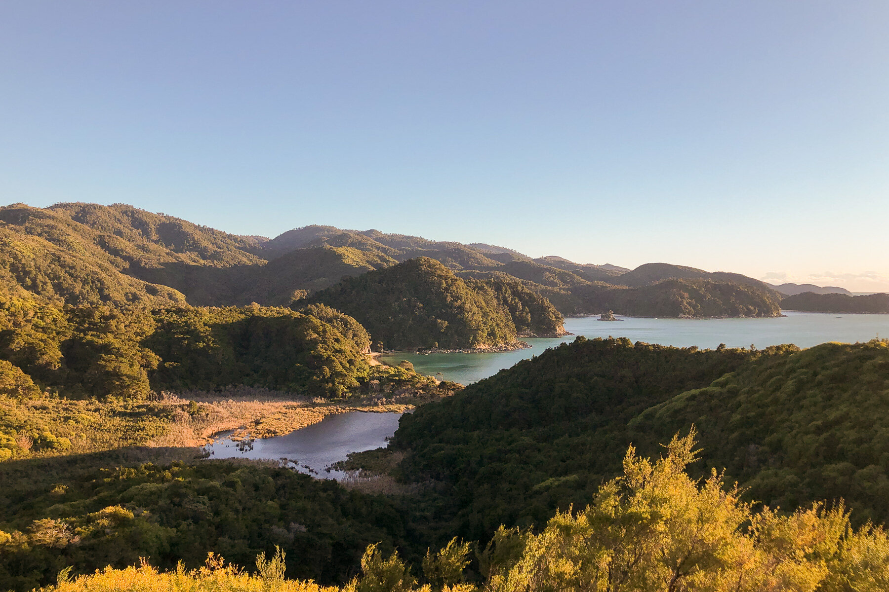
DAY 3 - ABEL TASMAN NATIONAL PARK
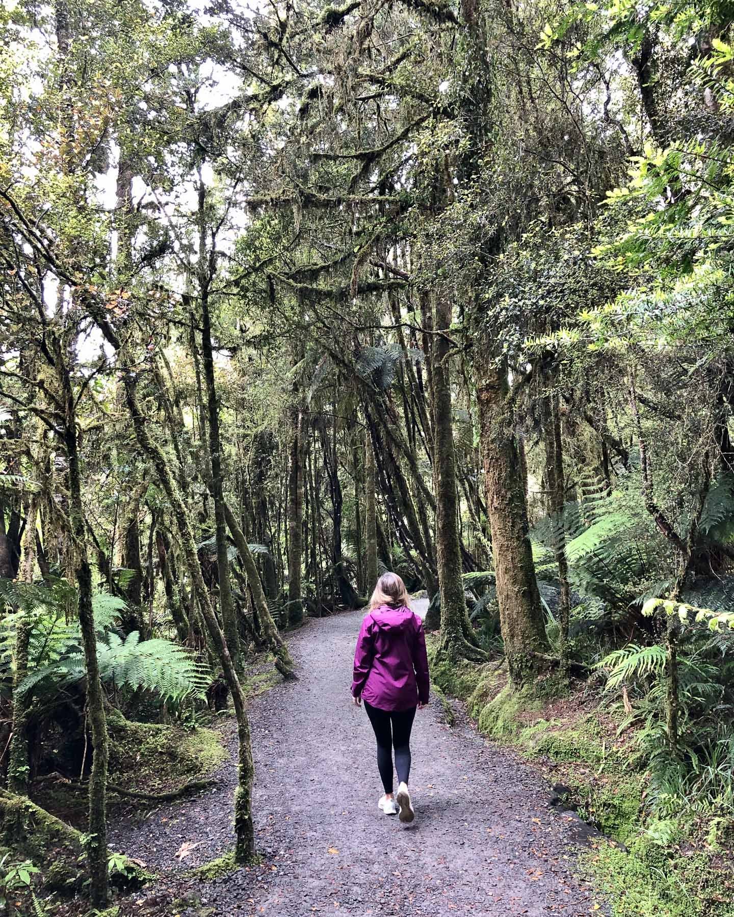
The Abel Tasman National Park is the smallest national park in New Zealand, but what it lacks in size, it more than makes up for in its amazing vistas and huge range of activities.
Along with the Abel Tasman Coast Track, the many other activities include kayaking, boating, camping, spotting seals, penguins and dolphins, mountain biking, or exploring some of the other hiking trails.
With a whole day in the park, there are many different ways to explore combining kayaks, water taxis and your two feet. Perhaps take a water taxi up to to Anchorage or Torrent Bay and either kayak your way back, exploring the hidden bays as you make your way back to Mārahau, or go via foot through the native bush (a walk from Anchorage back to Mārahau will take 4hr / 12.4km). But there’s so many tours and options available so there’s options for everyone.
» ADDITIONAL TIME IN THE ABEL TASMAN NATIONAL PARK?
ABEL TASMAN COAST TRACK
This multi-day hike can add an extra 2-3 nights to your itinerary.
For route options and how to plan hiking the Abel Tasman Coast Track, see my blog post:
Read More: A Guide to Hiking the Abel Tasman Coast


DAY 4 - BULLER GORGE & UPPER WEST COAST
Drive Time: 3h 45m | Drive Distance: 270km
» BULLER GORGE
MARUIA FALLS
Just before the start of the Buller Gorge, take a slight detour to visit these unique falls. One of the widest waterfalls you’ll come across in New Zealand and these falls are pretty new - they were only created in the 1929 Murchison earthquake. A landslide diverted the course of the river over an old bank.
BULLER GORGE SWINGBRIDGE
As the road through the gorge follows the river deep down in the canyon, you’ll soon come across the incredible Buller Gorge Swingbridge - the longest swingbridge in New Zealand at 110m in length! There are a variety of walks from the swingbridge ranging from 15 minutes to 1hr. For an alternative river crossing, there’s also a high speed zipline ride.
WHITE WATER RAFTING
For those feeling adventurous, the Buller Gorge is a popular location for white water rafting with Grade 3 or 4 rapids.
» PUNĀKAIKI
PANCAKE ROCKS & BLOWHOLES
These fascinating limestone rock formations resemble - yep, you guessed it, stacks of pancakes. Originally formed as solidified mud on the oceanbed, they have been exposed following seismic events in the area and the erosion from the elements has created the pancake-looking effect.
The water has also created cavernous holes in the formations, which force the sea water through to create impressive sprays of water.
The formed route is only 1km/20min but allow extra time to stop and appreciate the forces of nature.
PUNĀKAIKI CAVERN
Grab a good pair of shoes and a headlamp and head into the 130m cavern, carved into the limestone cliffs. The cave is a great place to see glowworms deep within the cave. Note that you’ll need a decent headlamp, a cellphone isn’t really strong enough.
» PAPAROA NATIONAL PARK
BALLROOM OVERHANG
The Ballroom Overhang track is a 2hr/6km one-way return route near Fox River that works well as a half-day hike. The route takes in amazing limestone formations as it follows the river to the impressive ballroom overhang. The route requires a river crossing and travel on the riverbed so this is best undertaken in dry weather. If in doubt, check with the DOC centre in Punākaiki.
PUNĀKAIKI - PORORARI LOOP
The Punākaiki - Pororari loop track is a 3hr/11km route near Punākaiki. This route follows the beginning of the Paparoa Great Walk track so is a great taste of the fill 3 day hike. The route climbs up over the ridge dividing the Punākaiki and Pororari river valleys. Take a small detour onto the Inland Pack Track to find a picturesque swing bridge before continuing on the loop.
» ACCOMMODATION NEAR PUNĀKAIKI
Campervan | Punakaiki Beach Camp
Located under the impressive limestone cliffs, this is the perfect place for exploring the Punākaiki sights.
Mid-Range | Scenic Hotel Punakaiki
With sweeping views beachfront views, this hotel is within walking distance of the famous Punakaiki rocks.
Luxury | Punakaiki Forest Retreat
This boutique accommodation is a romantic retreat located in beautiful native bush.
DAY 5 - THE GLACIERS
Drive Time: 3h | Drive Distance: 230km
The road south down to the glaciers follows the wild west coast. The road is extremely scenic however take care driving as this road is frequently subject to the extreme weather conditions and features a lot of narrow roads and one-way bridges! No multi-carriage highways in this region!
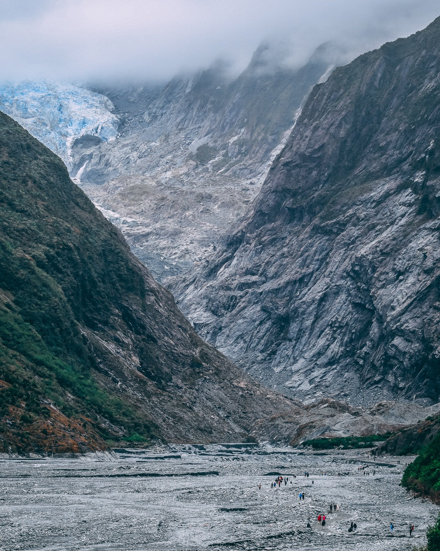
» THE FRANZ JOSEF AND FOX GLACIERS
The Franz Josef Glacier (Kā Roimata-a-Hinehukatere) and Fox Glacier (Te Moeka-o-Tuawe) are highlights of a trip to New Zealand. These incredible ice formations showcase both the power and beauty of nature. However, these magnificent wonders are sadly and quickly disappearing at a rate of 1.5m per year due to the impacts of climate change.
One of the most popular ways to see the Franz Josef Glacier/Ka Roimata-a-Hinehukatere is via the 5.4km / 1h 30m walkway just south of the town centre at the end of the Glacier Access Road.
To get as close as possible by foot to these forces of nature, wear appropriate footwear as the second half of the trail is not well formed and the route passes over uneven stones - there may also be small streams to ‘rock-hop’ across. The final viewpoint also adjusts frequently due to the ever-changing and unpredictable river that flows from the glacier. The walkway and viewing areas are carefully managed by DOC, so be sure to follow all of their warnings and signage displayed at the track.
Neither the actual Franz Josef or Fox Glaciers are accessible by foot anymore. Heli-hike tours are available to experience the glacier up close.

WEST COAST WILDLIFE CENTRE
This centre is a wildlife conservation initiative with an interactive experience to see and learn about one of New Zealand’s vulnerable, threatened species, the rowi Kiwi. Guided tours are also available.
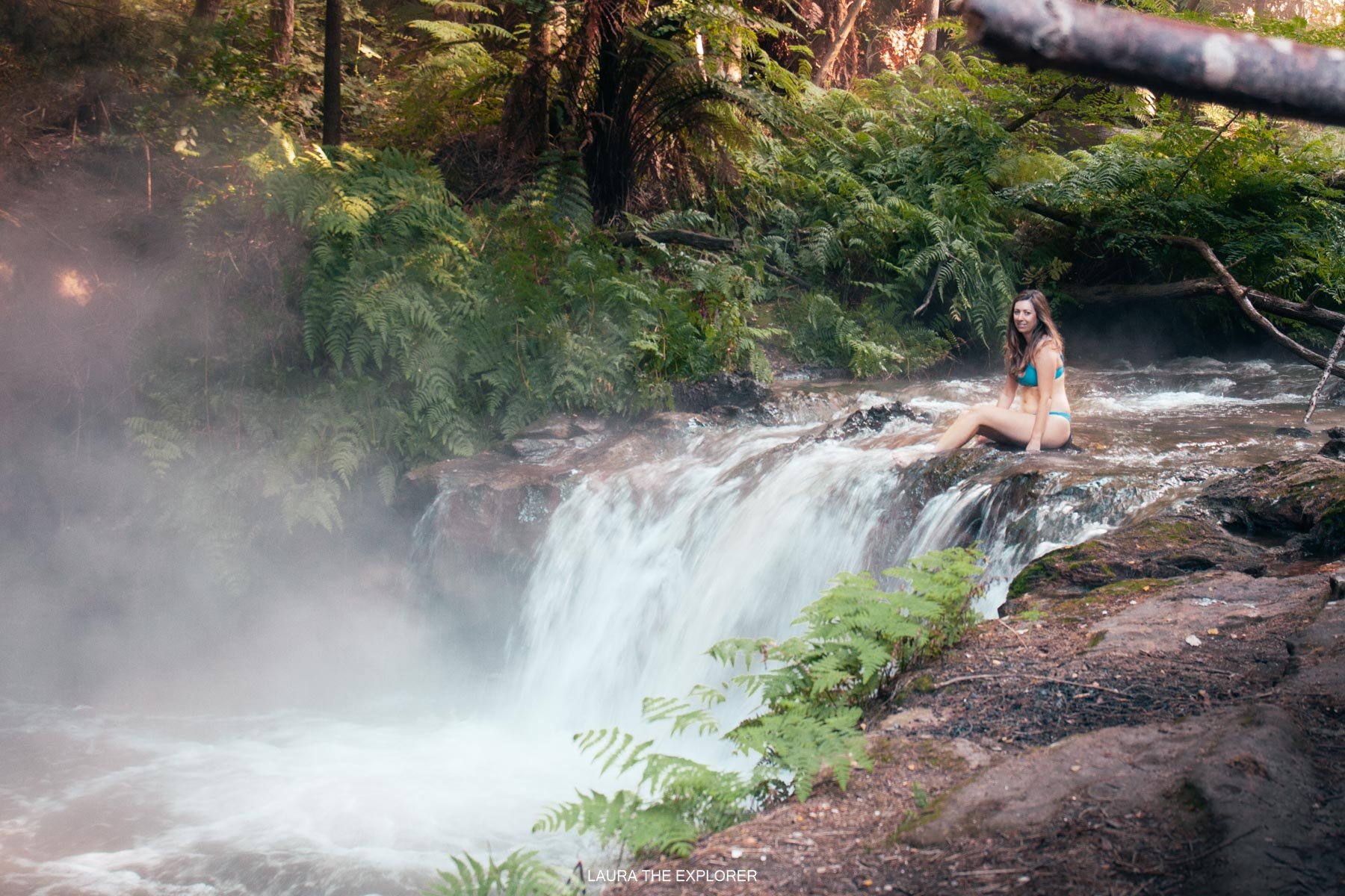
HOT POOLS
If you didn’t get a chance to visit the Maruia Hot Springs (see alternative itinerary suggestions further down), here in Franz Josef there are two different options to soak in to. The Glacier Hot Pools are a wonderful, sheltered spot for a relaxing soak amongst the fern forest. The second is newly opened Waiho Hot Tubs, with secluded private hot tubs where each is refilled after each guest and the temperature can be adjusted to your preference.
» ACCOMMODATION NEAR FRANZ JOSEF OR FOX GLACIER
Campervan | Gillespies Beach
One of the best DOC campsites in New Zealand, Gillespies is located on a quintessential west coast beach. Think windswept tussocks and the mighty surf pounding the rocky shore. Let the sound of the ocean lull you to sleep. Like most West Coast beaches, we recommend bringing some sandfly repellent here!
Mid-Range | Rainforest Retreat
Nestled into the beautiful, native rainforest are the deluxe treehouses. Some of the options include a hot tub to relax and unwind for the evening.
Luxury | Te Waionui Forest Retreat
This luxurious retreat is the perfect place to relax after a busy day exploring the West Coast glaciers.
DAY 6 - HAAST HIGHWAY (TĪORI PĀTEA) & MAKARORA VALLEY
Drive Time: 3h 30m (but allow more for lots of stops!) | Drive Distance: 285km
» FOX GLACIER
Before heading out to the incredible Haast (Tīori Pātea) Highway, start your day with a 1.5hr / 2.6km walk around glacial-fed Lake Matheson (Te Ara Kairaumati) and brunch at the cafe sitting right next to the lake. On a clear day, the lake provides a perfect mirror image of Fox Glacier (Te Moeka-o-Tuawe) in the mountains beyond - it’s a stunning spot that sets the theme of the day ahead.

» HAAST HIGHWAY (TĪORI PĀTEA)
From here, the road through to the Makarora Valley and on to Wanaka will tease you with incredible views the entire way - and it’s full of picturesque places to stop.
SHIP CREEK
This tidal lagoon and shorefront is the perfect place to stop for a stretch before leaving the coast and heading inland. Forming part of the Tauparikaka Marine Reserve, the beach is one of the best places in the world to see the Hectors Dolphins, these small creatures regularly play in the waves right next to the beach.
DO GO CHASING WATERFALLS
There’s no shortage of spectacular waterfalls along the Haast Highway, so the easiest way to decide where to stop might be to chose the one with space in the carpark!
Roaring Bill Falls - 1km / 20m return walk - these 30m falls cascade over a pile of huge boulders. The deep turquoise colour of the Haast river is also devine.
Thunder Creek Falls - 0.2km / 5m return walk - get up close to these powerful falls, located just off the road. Also, if you’d like to snap a photo of the water churning through the Gates of Haast, the best bet is to walk up the road from here.
Fantail Falls - 0.2km / 5m return - last but not least, these falls tumble beautifully down the rock face, representing a piwakawaka (te reo Maori for fantail).


BLUE POOLS
The famous blue pools are the most popular sight along the highway, and you may need to park up on the side of the road in order to stop and visit. Cross the swing bridges for views of these striking crystal clear aqua pools. The walk itself is 3km / 1hr, but allow time to take photographs.
Back on the road, as you emerge from the trees at the top of Lake Wānaka, be prepared to be awed by the sparkling blue waters fringed by jagged mountains of Mt Aspiring National Park.
» ACCOMMODATION NEAR WĀNAKA
Campervan | Glendhu Bay
There are a few campervan options in town, but for a lakefront destination, make the 15m drive around the lake to Glendhu Bay. This spot is popular with locals so you’ll need to book in advance over the summer holidays.
Mid-Range | Golfcourse Road Lodge
Located next to the golf course, but still within walking distance to the town centre.
Luxury | Cross Hill Domes
These dome pods offer floor to ceiling windows and provide a unique perspective for stargazing from the comfort of your bed. Regular camping this is not - these pods also climate control for year round comfort and relaxation.
DAY 7 - WĀNAKA
Having spent many a summer holiday here growing up, Wānaka holds a lot of special memories for me. Whilst ‘older me’ isn’t as keen as ‘younger me’ to jump in the icy cold water (it takes the high-summer Central Otago heat to convince me these days!) there’s still a strong pull to continue enjoying and exploring this region.
Wanaka is surrounded by truly amazing hikes and with limited time, the challenge is narrowing down the options when there are so many world-class choices. Some of the trails are extremely popular, such as Mt Iron and Roys Peak, but they are worth the hype - the views from Roys Peak and the accessibility of Mt Iron mean they get very busy during peak season.
It’s also nice to relax and explore the lakefront town and it’s surrounds. There’s a huge range of things to do to suit every type of traveller here in Wānaka. Start the day with a delicious brunch from Federal Diner, or grab something to go from their takeaway off-shoot Fedeli.
» WALKS AND HIKES NEAR WĀNAKA
Mt Iron - 4.5km / 1h 30m
Mt Iron is a great bang for your buck - if you want to check out some epic views but don’t want to dedicate a huge part of the day to a hike, this is the one to choose. The glacier carved monolith offers incredible 360 views over Wānaka, Albert Town and Hāwea Flat.
The hike is extremely popular, and is also exposed to the hot midday Central Otago sun, so during summer hit the trail early or late in the day if possible. There’s now a large carpark just off the main road in to Wānaka (SH84), or is within walking distance of the town centre. Most people prefer to complete the walk clock-wise from the carpark, but it can be walked in either direction.

Roys Peak - 16km / 5-6h
Plastered all over Instagram, it’s hard to miss the beauty (and popularity) of Roys Peak. You’ll need to put in some steps to be treated to these views though - it’s a steep trail that gains over 1200m of elevation on the way to the top. However with views across Lake Wānaka on one side and Mt Aspiring National Park on the other, it is worth the hard slog. Getting up early to watch the sunrise is pretty magical, though depending on the time of year, you’ll need to start in the early hours of the morning. To avoid the crowds in summer, start early or time it for the end of the day when the crowd is on it’s way back down.
Alternative mountain top hikes similar to Roys Peak are the Diamond Lake Lookout and Isthmus Peak.
Check out my guide: The Best Wanaka Hike? Why Roys Peak At Sunrise Is Totally Worth It


Rob Roy Glacier Track - 10km / 3-4hr
For something a little different, and far less crowded, continue out past Glendhu Bay into the Matukituki Valley to find the Rob Roy Track. This hike features spectacular vistas of waterfalls, dramatic rock cliffs, snowcapped mountains and the Rob Roy Glacier. The drive does take about an hour from Wānaka but the stunning alpine views on the road alone are worth the journey. Parking is available at Raspberry Flat. Over winter, follow all avalanche warnings and guidance.
» SWIMMING SPOTS AT LAKE WĀNAKA
If you’re looking to cool down in the blue waters of Lake Wānaka, you’re not just limited to the main waterfront along Ardmore Street. Venture out to one of these spots:
Waterfall Creek - can be accessed via road or on foot via Waterfall Creek Track from the centre of town.
Bremner Bay Beach - is a very shallow beach where can walk out quite aways before the level drops off. This makes it great for kids but also keeps the water a bit warmer than other swimming spots.
Dublin Bay - take the Dublin Bay Rd turnoff just outside of Albert Town for this quiet bay most popular with locals. Plenty of parking is available.
» WINERIES NEAR WĀNAKA
Central Otago produces some of the best wine in the world and Wānaka is home to some of these world-class wineries. Visiting a cellar door or two is definitely a must-do when so many delicious options are on offer.
One of the four original Central Otago wineries, this family-run winery has been producing outstanding wines for generations. Book a tasting to sample their biodynamic wines whilst enjoying breathtaking views of the lake and mountains beyond.
Located up behind the Wānaka golf course on the aptly named Gold Course Road, this family-run winery’s enchanting cellar door delivers award winning wines in tasting paddles, and also offers a small grazing menu. In addition, their on-site restaurant, Bistro Gentil, is the perfect place to celebrate a special occasion.
If spririts are more your jam, the local Cardrona Distillery is located on the road between Wānaka and Queenstown, so is easiest visited on your way through to Queenstown. In addition to the cellar door, distillery tours can be booked in advance and will take you through the distilling process with a tutored tasting to finish it off - delish!
» WĀNAKA LAVENDER FARM
Featuring row after row of beautiful lavender, Wānaka Lavender Farm is the perfect place to frolick amongst the flowers. Sample some honey and enjoy a refreshing lavender ice cream as you say hello to the retired and orphaned farm animals (including highland cows, miniature horses and alpacas) that now call this farm home. The farm is located on SH6, a 5 minute drive out of town.
» THAT WANAKA TREE
#ThatWanakaTree, maybe the only tree in the world that has it’s own hashtag? The dangling branches of this old willow make a beautiful focal point to the alpine backdrop. It’s easy to find - head around the lakefront and find the queue of people waiting to get their shot. Note: please don’t climb on this delicate beauty.


» ADDITIONAL TIME IN WĀNAKA?
LIVERPOOL HUT
An overnight hike to Liverpool Hut will add one night to the itinerary.
Head out past Glendhu Bay into the Matukituki Valley to find the Liverpool Hut trailhead - Raspberry Flat - which is actually the same carpark as the Rob Roy Glacier hike mentioned earlier in the main itinerary.
The track to Liverpool Hut is made of two sections - Raspberry Creek to Pearl Flat section, which is also know as the West Matukituki Track, and the Pearl Flat to Liverpool Hut section, which includes the steep climb up to the hut.
The trail to the hut is 15km / 6h 30m each way and is designated as an advanced tramping track by DOC. The hut needs to be booked in advance and you’ll need to carry all your gear including all cooking equipment, food and warm, waterproof clothing. Confirm conditions in advance with the iSite/Department of Conservation centre in Wānaka before heading out.
DAY 8/9 - QUEENSTOWN (TĀHUNA)
Drive Time: just over 1hr | Drive Distance: 70km
The Crown Range Road that traverses the mountains that divide Wānaka from Queenstown is another of the most beautiful routes in the country.
Head up through the snowcapped mountains of the Cardrona Valley before winding back down the many switchbacks to Arrow Junction on the other side. Stop in at the Cardrona Pub for something to eat in the back garden, it’s a local institution.
» QUEENSTOWN (TĀHUNA)
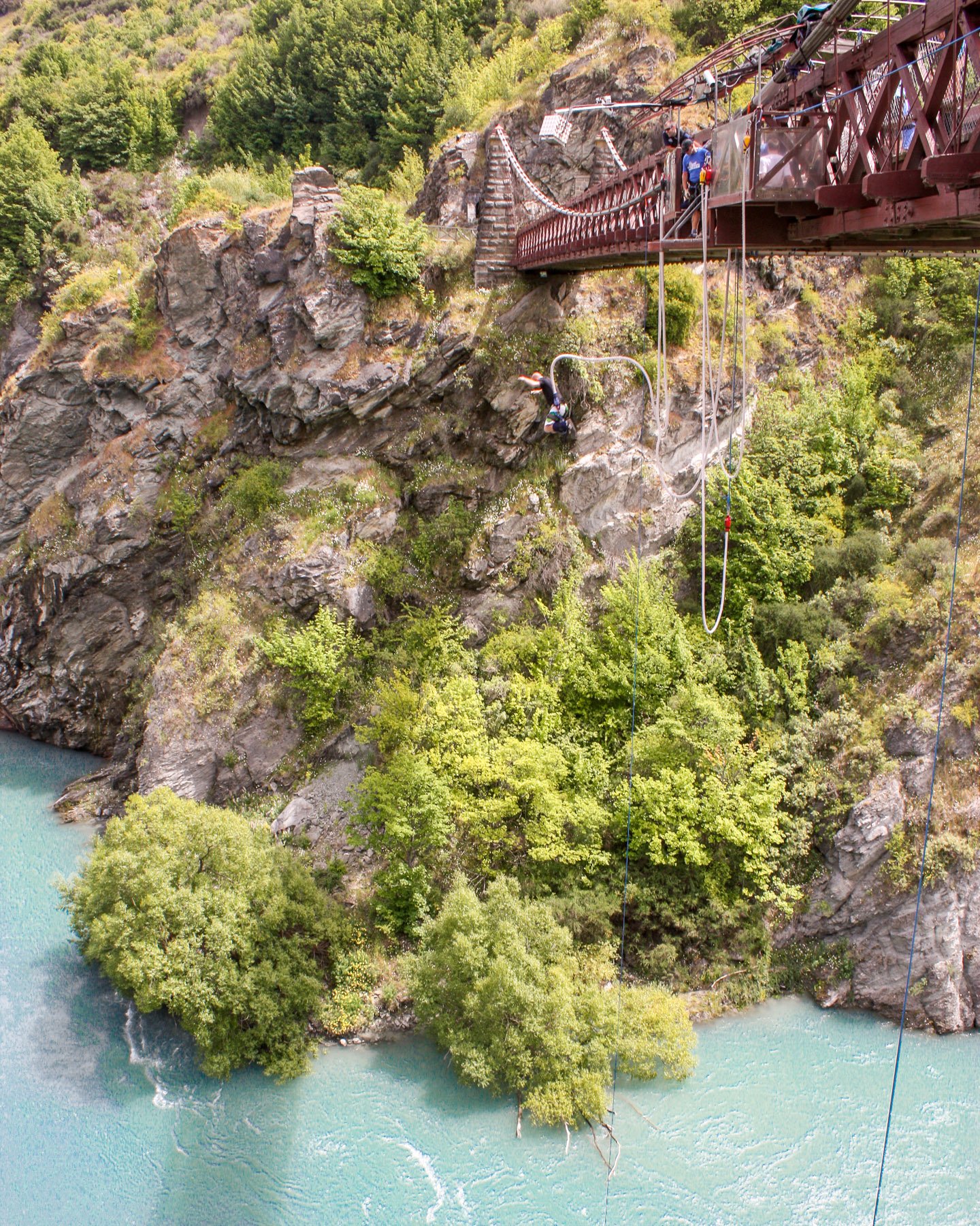
Queenstown really needs no introduction, it’s known across the globe as the adventure capital of New Zealand, with enough attractions to easily fill a week, let alone a couple of days.
In addition to the adrenaline-pulsing activities like bungy jumping, jet boat riding and skydiving, Queenstown also boasts winery cycle tours, world-class golfing, old mining settlements and an array of mouth-watering restaurants serving up fresh, locally sourced ingredients. The town is also the perfect launching pad for epic day trips and mind-blowing hikes.
Fill your two days in Queenstown with some of the following highlights:
ADRENALINE ACTIVITIES AROUND QUEENSTOWN
Bungy Jumping | originating right here, New Zealand’s bungy jumps are legendary. Try the OG, a 43m jump off the Kawarau Bridge, or test your nerve on the heart stopping 134m Nevis bungy or swing. Book in advance to secure a time slot.
Jet Boating | a ride on one of these epic machines will get your heart racing. The original Shotover Jet at Arthur’s Point hurtles through the awesome Shotover Canyon, whilst the KJet screams across Lake Wakatipu and up the Kawarau & Shotover rivers.
Sky Diving | whilst I prefer my feet firmly on the ground, if you’ve ever wanted to jump out of a plane, this is probably one of the prettiest places in the world to look down on!

SLOWER-PACED (BUT NO LESS ENJOYABLE) ACTIVITIES AROUND QUEENSTOWN
Explore the Town Centre | Exploring central Queenstown is an easy way to start or end your day. Pick up a coffee and a sandwich from local fave Vudu Cafe and wander along the waterfront to lush Queenstown Gardens. Or pick up a iconic Fergburger or Devil Burger (they’re just as good, and a way shorter queue!) and cosy up on the lakefront wall and watch the sun drop over the lake. There’s also the option to head up Brecon Street and take the Skyline Gondola (or walk the Tiki Trail up!) for sweeping views over Queenstown and fun on the luge.
Winery Tour by e-Bike | if you didn’t make it to a winery in Wanaka, it should definitely be on the list for Queenstown, the home of Pinot Noir. Take an e-bike tour of Gibbston Valley and along with outstanding wine, there are amazing views and a cheesery to enjoy. Follow the cycle paths and there’s no need to limit the tastings or worry about how you’re getting home.


Goldfields Mining Centre - take the very scenic route through the Kawarau Gorge to the Goldfields Mining Centre. Learn about the historic gold rush that originally bought settlers to this area as you explore the primitive stone villages and try your hand at panning for gold - you’re still very likely to discover some!
Lake Hayes - walk or cycle the 8km route around stunning Lake Hayes. The flat walkway encompasses the entire lake located smack bang in the middle of the Wakatipu basin. Make a slight detour to Mora Wines’ cellar door and restaurant when you’ve worked up an appetite.
» Arrowtown (Haehaenui)
This old mining town still features many of the original buildings from the bygone era, now filled with delicious bars and restaurants and boutique stores to discover. The town features a wealth of trails, but I highly recommend taking local favourite Tobin’s Track for an incredible view over the Wakatipu Basin. From the main parking lot on Ramshaw Lane, follow the river around until you reach a footbridge where the trail is clearly marked. If you are lucky enough to visit Arrowtown in Autumn, the old oak, sycamore, elm and ashes trees that fill the town all turn the most beautiful shades of gold.

» Glenorchy
The 45km drive along the lake edge from Queenstown to Glenorchy technically only takes 45 minutes, but it would be a crime not to make at least one stop along this famous road.
Ithilien Lookout | Lord of the Rings buffs won’t want to miss this filming location, a short walk off the main road.
Bob’s Cove | take the 30 minute loop track up to the lookout for 360 degree views.
Bennett’s Bluff Lookout | for views up and down the lake, backed by the snowcapped mountains.
Glenorchy Wharf | the iconic Glenorchy view can’t be missed and is the main drawcard for a trip out to Glenorchy.
ADVENTURE ACTIVITIES AROUND QUEENSTOWN
Queenstown Hill - don’t let the word ‘hill’ mislead you, this hike gains 500m of elevation over it’s 2.5km ascent. The hike takes between 2-3 hours but you’ll be rewarded with amazing views of the lake and surrounding mountains. Make it up for sunrise and watch the sun appear over the mountains without the crowds. Unlike some other trails, this hike can usually be completed any time of year. Add extra time if you head out from town rather than official start point on Belfast Terrace where parking is limited.
Ben Lomond Track - the 14km 6-8hr full day hike (with up to 1400m of elevation gain!) has some of the best panoramic views of Lake Wakitipu and make this beautiful hike worth the effort. The official track starts at the One Mile Creek carpark, however to save 3km/450m elevation uphill, take the gondola up to the Skyline and join the track from there. Follow any DOC warnings on the conditions during winter and spring.
Routeburn Falls Hut - a one-day return hike from the Routeburn Shelter to Routeburn Falls Hut is a great way to experience one of the world-class New Zealand Great Walks if your itinerary doesn’t allow time for a full multi-day hike. This trail up the glacier-carved valley is about 20km / 6-8hr return and starts about a 25km drive further along from Glenorchy. Follow any DOC warnings during winter and spring as avalanches may reach to upper section of the trail near the Falls Hut.
» ADDITIONAL TIME IN QUEENSTOWN?
If you have more than two weeks for your trip, consider adding an additional day in Queenstown. With a huge range of activities on offer, it’s handy to have an extra day up your sleeve to explore the area, particularly if bad weather delays any must-do activities.
» ACCOMMODATION NEAR QUEENSTOWN
Campervan: Queenstown Holiday Park
This campsite is conveniently located in central Queenstown. Ensure to book in advance over the busy summer period and be aware that freedom camping is extremely restricted in the Queenstown area.
Airbnb: Absolutely Lakefront Apartment
Overlooking the garden, lake and mountains, this apartment is conveniently located on Frankton Road, with easy access to both central Queenstown and beyond. There’s also a walking track that runs along the front of the property that takes you all the way into town.
Luxury: Kamana Lakehouse
This luxurious hotel features designer rooms with views across the lake, private hot tubs and one of the best restaurants in Queenstown, Nest.
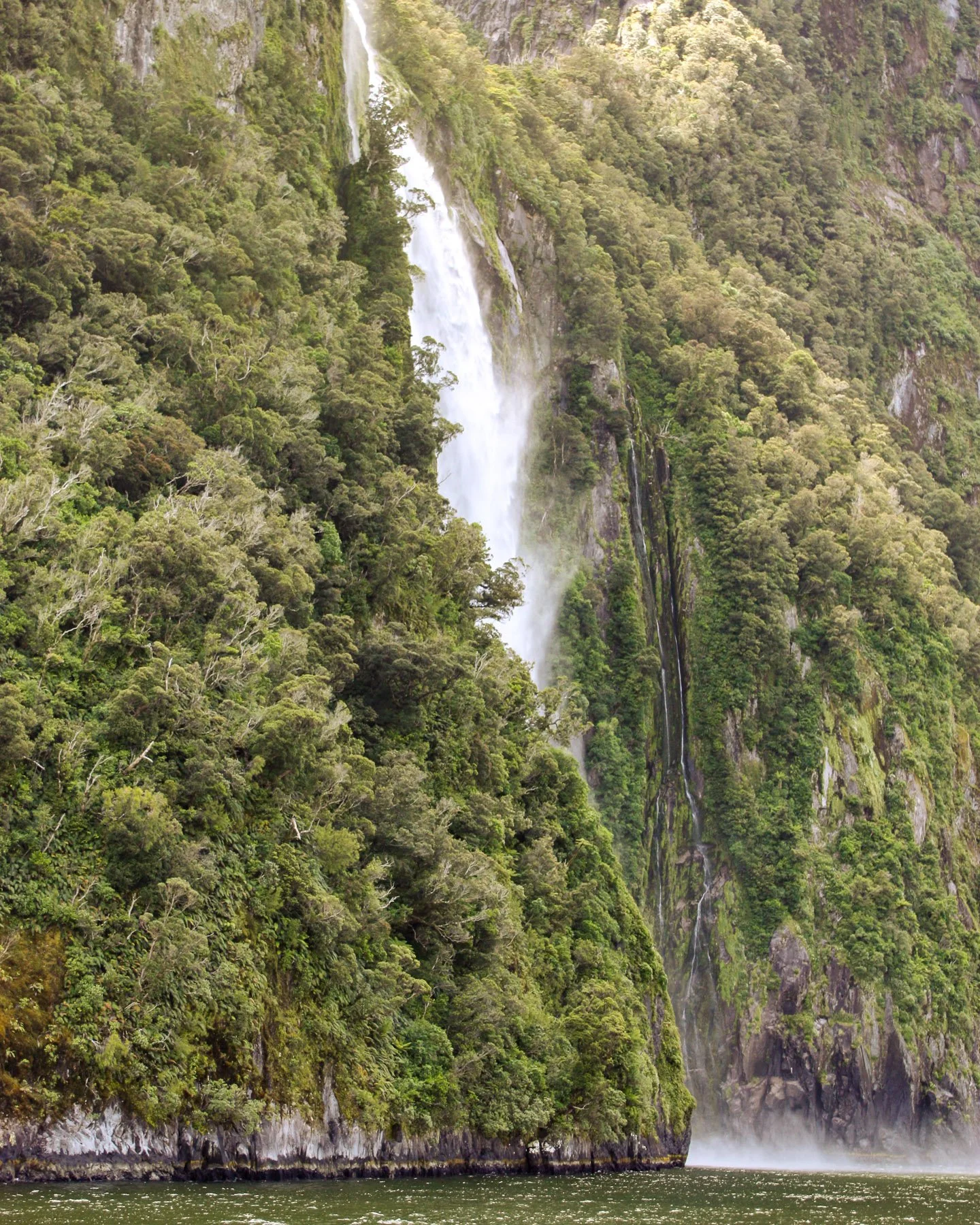
DAY 10 - MILFORD SOUND (PIOPIOTAHI)
Drive Time: 3h 30m (but allow more for stops) | Drive Distance: 290km
Add this one to the growing list of most amazing roads in New Zealand. The lake and mountain views, the waterfalls, the famous Homer tunnel - be prepared for more than a few stop offs on your way through to Milford Sound.
» TE ĀNAU
This picturesque lake-side town is the hub for the remote attractions beyond. It’s the best place to pick up any supplies you may need for the next couple of days as options are limited in Milford Sound.
Mirror Lake - Just off beside the road this small, sheltered lake creates a perfect mirror image of the mountains surrounding it.
Homer Tunnel - one of the few times in life you’re going to hope to be stuck at a red light! The queue to pass through the alternating one lane tunnel runs in between magnificent snow-capped mountains and couldn’t be a more beautiful place to await the green light.
The Chasm - once you wind your way down from the tunnel, take the 15 min walk through the trees to see how the powerful force of water has dramatically shaped the rocks of the Cleddau River.


» MILFORD SOUND (PIOPIOTAHI)
Commonly referred to as the 8th wonder of the world, Milford Sound is a highlight on any visit to the South Island. Towering mountains plunge down into the ocean as foaming waterfalls carve their way down the sheer rockface. On the waters edge, fur seals play amongst the rocks and the local pod of Bottlenose dolphins might catch a wave in the boat’s wake.

Boat tours are the most common way to experience the Sound, though kayak tours are also available for those feeling a little more adventurous. If possible, plan to take either a late afternoon boat tour, or an early tour first thing the next morning to avoid the crowds on the water. Depending on where you stay, allow an extra 20min for any wait at the Homer Tunnel and then another 15 mins walk from the carpark to the cruise terminal - both need to be factored into your arrival time.
The fiord can be visited at any time of year, though the best time is after a rainfall - the waterfalls really come alive and are at their most impressive. Carry a jacket at any time though - chances are you’ll get up close and personal with a waterfall or two.
Before leaving Milford Sound, take a quick walk to this viewpoint for a great photo op!

» ACCOMMODATION NEAR MILFORD SOUND
Campervan: Rainforest Campervan Park
The only campervan location is Milford Sound is surrounded in world-heritage listed native bush. Staying here provides the opportunity to be one of few to experience both the sunset and sunrise over Milford Sound.
Airbnb: Fiordland National Park Lodge
Located about an hour and a half drive from Milford Sound, this lodge is the closest affordable accommodation to Milford Sound, and tucked into the edge of Te Anau Lake, this is a beautiful spot to use as your base.
Luxury: Milford Lodge
As the only full accommodation available in Milford Sound, this lodge lives up to the high standards of the amazing scenery that it’s nestled in. Riverside chalets are the perfect place to experience the serenity and isolation of the sounds.
DAY 11 - THE CATLINS
Drive Time: 6h 30m | Drive Distance: 465km
Due to the remoteness of both Milford Sound and today’s destination, The Catlins, there is a bit of a driving involved, however this rugged, untouched southern coast is worth the kilometres. After passing through farmland, this remote corner of New Zealand will hit you with the most amazing natural features. If conditions are right, you might even experience the Aurora Australis that can light up the Catlins (geomagnetic storm required!).
» THE CATLINS
CURIO BAY (TUMU TOKA)
Located just around the corner from the southern most point in New Zealand is Curio Bay. Home to a petrified-forest, this natural phenomenon is a place of international significance and dates back to the Jurassic Period. The native Kauri and Matai fossils are around 170 million years old. Curio Bay is also home to a resident pod of Hector’s dolphins. I can still remember summer holidays as a child, swimming in the water with the dolphins who were playing in the waves.
MCLEAN FALLS
About 45 mins up the road, are the beautiful McLean Falls. There are so many waterfalls to choose from in the Catlins, and this one is worthy of the 4km / 30m return walk. The falls consist of a lower section that stretches out from the 22m upper section behind.
PŪRĀKANUI FALLS
Continue up the coast to the impressive Pūrākanui Falls, the largest and most spectacular falls in the region. A 20 min rainforest walk leads to the photogenic falls that cascade down several terraces. They’re even more impressive after rain.


CATHEDRAL CAVES
Just up the road are the huge, vaulted Cathedral Caves - not to be confused with the North Island’s Cathedral Cove! These impressive caves reach 30m high and extend for 200m, this grandeur giving them their name. Open from October to May, confirm the tides before your arrival as this beauty can only be visited 1.5hrs either side of low tide. Accessed via Waipati Beach, there is a $10 fee to cross Tangata Whenua (Māori) land.
NUGGET POINT (TOKATĀ)
This iconic lighthouse and rocky outcrop are one of the most famous landmarks in the region. The 15 min pathway winds around the cliff to reach a viewpoint underneath the lighthouse. Get there for sunrise to watch the glow over the horizon. Also near the carpark is Roaring Bay - home to endangered yellow-eyed penguin (hōiho). These amazing animals should not be disturbed so follow signage and use the hide for observation.


» ACCOMMODATION NEAR THE CATLINS
Campervan: Pūrākanui Bay Campsite
This DOC campsite but beautifully located, sheltered into the hillside of the rugged and remote Purakanui Bay beach. Enjoy the isolation but come prepared as there are limited supplied available in the area.
Airbnb: Seascape Apartment
Just a hop, skip and a jump from the sands, the Seascape Apartment is located as close to Kaka Point beach as you can get. Sit and enjoy sweeping views of the ocean from the balcony.
Luxury: Catlins Mohua Park
Each of the four eco cottages are nestled into their pocket of native bush with sweeping views over the farmland. Guided scenic and widlife tours are also available.
DAY 12 - DUNEDIN (ŌTEPOTI)
Drive Time: 1h 30m | Drive Distance: 100km
» DUNEDIN (ŌTEPOTI)
It’s an easy drive up to Dunedin this morning. The city, perhaps most well known for it’s Scottish heritage and large student population, also has many amazing natural attractions. Head out to the Otago (Ōtakou) Peninsula to explore the wild beaches and unique wildlife who call it home, before heading back into the vibrant city centre to discover it’s juxtaposition of heritage architecture and amazing street art.
TUNNEL BEACH
On the south side of the city is this amazing trail that’s been popular with locals forever, but has just started to become more well known thanks to social media. It’s a 1hr return trip through farmland to the spectacular coastline that has been eroded away by the powerful waved to create a giant natural archway. A tunnel staircase, carved by the old land owner, takes you down to the rocky shore. Take care out on the exposed areas of the rock.

ROYAL ALBATROSS COLONY
Tairoa Heads (Pukekura) out on the peninsula is the only human-inhabited mainland location in the Southern Hemisphere with a breeding colony for these majestic northern royal albatross (other locations include some of the Chatham and Auckland Islands). The not-for-profit Royal Albatross Centre offers guided educational tours, with viewing opportunities for nesting chicks varying throughout the year. On breezy days its possible to see these graceful creatures soaring around the headland.
YELLOW-EYED PENGUINS
Also out on the peninsula is a yellow-eyed penguin conservation reserve. Funded entirely through tourism, this conservation project provides important care and protection for these endangered penguins, many of which are are sick, starving or injured. Tours cross private property and pass through a range of hides to non-intrusively view the penguins in their native habitat. There are only an estimated 265 breeding pairs left in the wild, the serious decline attributed to a lack of food, disease and land predators such as dogs and other introduced species.


HERITAGE ARCHITECTURE
The city centre was originally designed to emulate the romantic design of Edinburgh, influenced by the strong Scottish presence settling in Dunedin in the 1800’s.
Dunedin Railway Station - completed in 1904, this railway station is said to be the second most photographed building in the Southern Hemisphere (after the Sydney Opera House). Step inside to find the beautiful, intricate mosaic floor.
University Clock Tower - completed in 1879, this gothic revival clock tower is the heart of the university precinct.
Otago Museum - completed in 1877, the museum house one of the largest collections in New Zealand with a focus of natural sciences. The museum holds many significant collections, in particular only two of three complete moa eggs in the world.
First Church - completed in 1873, this church is considered the most impressive 19th century church in New Zealand. The church features a lofty spire; rumour has is that architect Robert Lawson sailed into the harbour and couldn’t see the church, so had the spire rebuilt higher than the original.
St Paul’s Cathedral - this cathedral is rather unique. Originally constructed in the early 1900’s, this gothic structure features flying buttresses, soaring stone pillars and an impressive organ, however due to funds running out, the church was never completed to the original Victorian design. Redesigned and finished in the 1970’s, the back half of church was finished in a modern style.
WAREHOUSE PRECINCT
For a completely different take on the city, download a trail map from the Dunedin Street Art website and take a tour around the warehouse precinct to discover some incredible new works of art. In the evenings, stop into Good Good for burgers, or in the morning, try Precinct for a delicious brunch.


» ACCOMMODATION NEAR DUNEDIN
Campervan: Dunedin Holiday Park
Located next to one of Dunedin’s most popular surf beaches, this is the perfect spot to stay if you’re keen to make a splash in the chilly southern waters or an evening wander along the white sandy beach.
Airbnb: City Heritage Apartment
On the edge of warehouse precinct, this 1880 heritage building has been redeveloped into apartments. Featuring gorgeous brick walls, this apartment is ideally located in amongst all the city centre highlights.
Luxury: Fable Dunedin
Originally constructed in the 1800’s, the building of this luxurious hotel has been a hotel for over 150 years. Wrap up in a cosy tartan blanket and enjoy the contemporary redesign of this heritage space.
DAY 13 - MOERAKI & AORAKI/MT COOK
Drive Time: 4h | Drive Distance: 320km
Today you’ll say goodbye to the southern coastline and head back into the mountains. Stock up on any food and essentials that are easy to find in the city.
» MOERAKI
These giant mysterious rocks were created by the cementation of mudstone in the Paleocene period some 60 million years ago - or put simply, these guys are old! Having been exposed over time by coastal erosion, these photogenic boulders are great fun to climb and jump across.
For lunch, stop in to legendary Fleur’s Place, an iconic restaurant serving the freshest seafood on the old Moeraki jetty. Bookings are essential.


» LAKE PŪKAKI
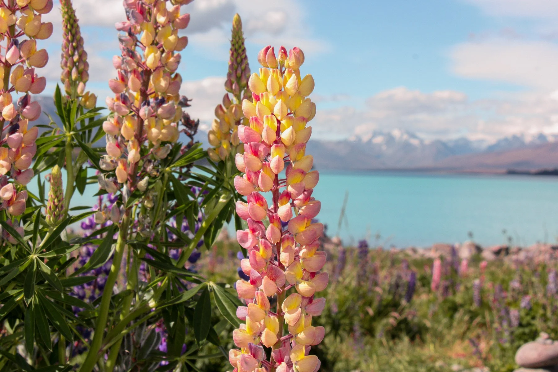
From the small town of Kurow (Kohurau), you’ll follow a series of lakes, all stunning hues of blue, before reaching the unbelievably blue alpine waters of Lake Pūkaki. Lake Pūkaki is the gateway to Aoraki/Mt Cook and the drive alongside the lake to the mountain village is one of the most scenic drives in New Zealand.
But the colour of the water is no photoshop saturation edit, the incredible turquoise colour is produced by ‘glacial flour’ suspended in the water.
Surrounded by mountains, the jewel in the rugged crown is snowcapped Aoraki/Mt Cook sparking away in the distance. Peter’s Viewpoint is an epic viewpoint that now has an extended carpark to accommodate it’s popularity.

» AORAKI/MT COOK
The best way to explore Aoraki/Mt Cook National Park is via one of the numerous trails that branch out from either the village or the White Horse Hill Carpark. With options for all ages and abilities, this World Heritage area is one of the most incredible areas to explore.
WALKS/HIKES IN AORAKI/MOUNT COOK NATIONAL PARK
Arriving in the afternoon provides the perfect opportunity to walk the Hooker Valley and watch the sun set over Aoraki Mt Cook. The 10km / 3hr return track crosses three swing bridges over roaring glacial rivers to reach the incredible Hooker Lake and uninterrupted views of Aoraki Mt Cook. With icebergs floating in the lake, wrap up warm as the wind can whip icily down the valley.
This hike also serves incredible views of Aoraki Mt Cook, Mueller glacier and Hooker Valley. Nicknamed the ‘stairway to heaven’ there’s a few steps required to earn these epic views. This route is the first half of the track to Mueller Hut, so is a great taste for those without time to complete the whole route up to the iconic hut.
For those short on time, the Kea Point Track is an easy 3km / 1hr path to a viewing platform overlooking the Mueller Lake and the glacier moraine wall, with Aoraki/Mt Cook behind.
Blue Lakes & Tasman Glacier View Track
Another short track, this 40m return follows steps up to a viewing platform overlooking the incredible Tasman Lake and Glacier. Only formed in the 1970’s, the lake provides scary evidence of glacial retreat due to the impacts of global warming. The Blue Lakes visible on the way up the viewpoint, but are now green coloured! This is due to them no longer being fed by the glacial waters.

DARK SKY PROJECT
One of the best parts about spending a night at Aoraki/Mt Cook is that it part of the Aoraki Mackenzie Dark Sky Reserve. Created in 2012, the reserve means light pollution is strictly controlled and is the only reserve of it’s kind in the Southern Hemisphere (there are only 8 in the world!). The best way to experience these amazing stargazing opportunities is through the Dark Sky Project. They offer educational tours to either the Mt John or Cowan Observatories where you can gaze through a 14” or 16” telescope and observe out-of-this-world (literally) views.
» ADDITIONAL TIME AT AORAKI/MOUNT COOK?
MUELLER HUT
This overnight hike will add one night to the itinerary.
Head off from Aoraki/Mt Cook Village for the amazing hike up to Mueller Hut. This hut is legendary for it’s epic sunset and sunrise views over Aoraki/Mt Cook and other features of the National Park.
The hike is 5.2km / 4hr each way and follows the Sealy Tarns Track (detailed earlier in the itinerary) for the first section. The upper section of the track is not so well formed and does involve scrambling across scree and identifying orange markers to follow.
Due to it’s popularity the hut should be booked and advance, and always register your trip with Aoraki/Mount Cook National Park Visitor Centre on the day you start as part of the safety precaution process.
» ACCOMMODATION NEAR AORAKI/MOUNT COOK
Campervan: White Horse Hill Campground
Nestled into the valley floor and surrounded by the biggest mountains in New Zealand, this basic campsite packs a punch. Well positioned to start many of the trails in the area, this campground is the ideal place to park up.
Midrange: Mt Cook Lodge
With no private/AirBnB options available in the village (the closest accommodation is in nearby Twizel), Aoraki/Mt Cook Lodge is a great, affordable option to stay in the village itself. All rooms feature mountain views and access is available to the full range of bars and restaurants.
Luxury: The Hermitage Hotel
A base for mountaineers for generations, this mountain retreat has been extensively remodelled over the years and is now the centre of Aoraki/Mt Cook tourism. All rooms in this luxurious alpine hotel have sweeping views of the Aoraki/Mt Cook. The complex also contains the Sir Edmund Hillary Alpine Centre, named after the world famous mountaineer.
DAY 14 - TEKAPO (TAKAPŌ)
Drive Time: 3h | Drive Distance: 230km
» LAKE TEKAPO (TAKAPŌ)
Head back along the ridiculously beautiful Aoraki/Mt Cook Road for a short drive through to the equally impressive Lake Tekapo.
MT JOHN OBSERVATORY
Even if you’re not planning on taking an astro-tour, make your way up to the Mt John Observatory to take in the amazing panoramic views over the Mackenzie Basin. The cafe makes this a great spot to grab a coffee or brunch, though in peak periods the carpark can become full, limiting access, so head out early or take the hiking trail from near Tekapo Springs.
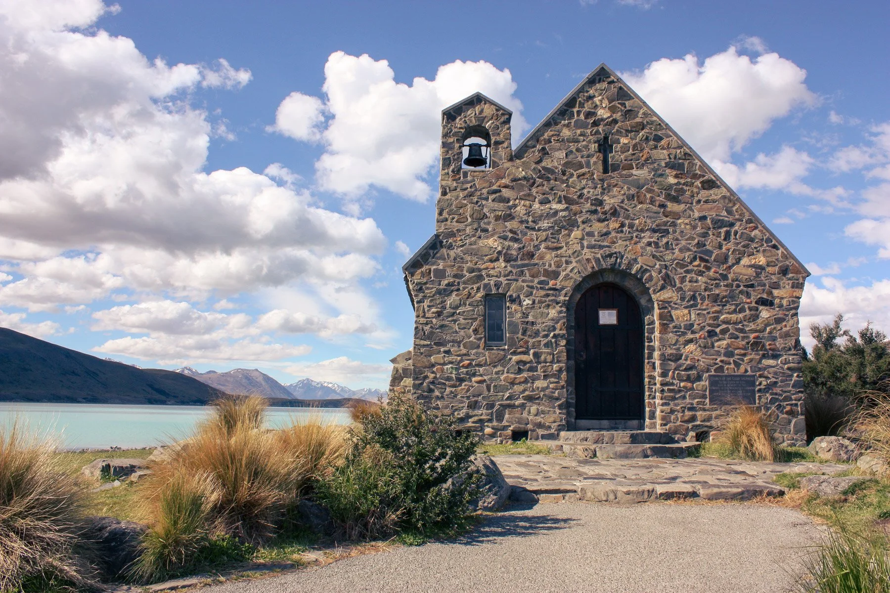
CHURCH OF THE GOOD SHEPHERD
Back down in the town, it’s hard to miss the Church of the Good Shepherd down beside the milky blue lake. This little stone church can hold but a few people, though is one of the most iconic images of the South Island. There’s plenty of parking and there’s now a pedestrian bridge over the Tekapo River, making it easier to access from the town. I’d recommend getting there early morning or late afternoon to avoid the many daytrippers!
» BACK TO CHRISTCHURCH
Depending on the timing of your flight out of Christchurch, either head straight back or take one of these route suggestions along the way:
PORT HILLS SCENIC ROUTE - adds 45m driving time, plus more for stops
At the small town of Selwyn, leave SH1 and head for the Port Hills. Follow Summit Road all the way along until Dyer Pass Road to drop back down into the Christchurch suburb of Cashmere. This route provides amazing views over the jagged Banks Peninsula.
AKAROA - adds 2h driving time, plus more for stops
Nestled into the Akaroa Harbour on the Banks Peninsula is the small town on Akaroa. One of the most historic places in New Zealand, it’s also one of the only places in New Zealand settled by French colonists and it still retains it’s French influence. Sitting on the edge of the calm harbour, this sleepy village is the perfect spot to relax - maybe grab a meal of fish and chips! - before heading back to the airport.
ALTERNATIVE SOUTH ISLAND ROUTE
» REDUCE THE ITINERARY BY ONE DAY
This option will reduce the overall itinerary by one day/night - to help if you’re limited on time, or want to add an overnight hike in somewhere along the way! This route skips the Abel Tasman section above and takes you through one of the famous Southern Alps passes instead:
DAY 2 ALTERNATIVE - LEWIS PASS OR ARTHUR’S PASS
Via Lewis Pass: Drive Time: 4hr 45m | Drive Distance: 365km
Via Arthurs Pass: Drive Time: 5hr 10m | Drive Distance: 400km
There are plenty of (epic) distractions along the way for either of these two passes, and it’s a hard choice between the two. Whilst Arthur’s Pass is a little more well known, Lewis Pass is slightly shorter and also offers picturesque views of the Southern Alps.
» TRAVEL VIA LEWIS PASS
MARUIA SPRINGS
Break up the journey with a dip at Maruia Hot Springs, the less famous but quieter and more relaxing version of the Hanmer Springs. They’re located in the middle of Lewis Pass next to the Maruia River and are a great way to unwind and enjoy New Zealand’s geothermal environment. Prepare to spend a couple of hours relaxing the in the thermal mineral waters.
REEFTON
Stop in at Reefton Distillery and sample their Little Biddy Gin, made from botanicals foraged from the local West Coast forests.
» TRAVEL VIA ARTHUR’S PASS (ŌTIRA-WAIMAKARIRI)
After stopping in Sheffield for an iconic pie, start the climb up to Porter’s Pass in the Southern Alps.
CASTLE HILL
At Castle Hill, take the easy 20min walk around the other-worldly Kura Tawhiti limestone formations, some up to 30m high. These impressive rocks were a setting for the film Narnia.

Just up the road is the Cave Stream Scenic Reserve, featuring a 594m long limestone rock tunnel. For those experience in caving/spelunking, there are two 30 minutes routes (one of the head of the tunnel and one to the end) that can be explored if you’re carrying appropriate footwear and lighting, and take any other precautions advised on site by DOC.
ARTHURS PASS TOWN
Continue over the pass and take in the expansive views of the Waimakariri River on route to the Devil’s Punchbowl Falls just after the township of Arthur’s Pass. Take the easy 1hr return track to the stunning 131m high falls. You might even spot a friendly kea while you’re here - just remember to put any food or shining objects away, these cheeky guys will take whatever they can get their hands on.
There’s also a good chance of spotting a kea at the Ōtira Viaduct Lookout. This impressive structure was built after the original road became impassible due to constant rockfall.


HOKITIKA
Later that evening, stop in at the Glow Worm Dell, located at the north end of Hokitika. At night these fascinating creatures are visible just a few metres from the road.
» ACCOMMODATION NEAR HOKITIKA
Campervan: Lake Mahinapua
This forest lined campsite is located on the edge of Lake Mahinapua, a popular picnic and camping spot.
Airbnb: Blue Spur Studio
This semi-rurally located studio overlooks a large garden and pond, with the resident herd of cows grazing in the farmland beyond.
Luxury: Rimu Lodge
This luxury lodge overlooking the Hokitika River has a strong ethos on sourcing local products and minimising it’s impact on the environment, and they grow their own produce for the breakfast.

WHERE TO GO AFTER THE SOUTH ISLAND?
A tour of the South Island is easily combined with a two week tour of the North Island (Te Ika-a-Māui), or for something different, head to New Zealand’s third largest island, Stewart Island (Te Punga o Te Waka a Māui).
» STEWART ISLAND (TE PUNGA O TE WAKA A MĀUI)
Take a ferry or a flight from Invercargill to the main centre of Oban.
RAKIURA TRACK
One of New Zealand’s Great Walks, the Rakiura Track passes through native bush and along the rugged coast over three days.
KIWI
Stewart Island is one of the best places in New Zealand to see kiwi in the wild, there are an estimated 20,000 on the island and even outnumber humans!
SEAFOOD
Stewart Island is the place to find some of the best seafood in New Zealand - delicacies include beautiful blue cod, salmon, lobster, paua and oysters.
Want to save this guide for later? Pin it!


This blog post was about: